"The important thing is not to stop questioning." - Albert Einstein
Research Works

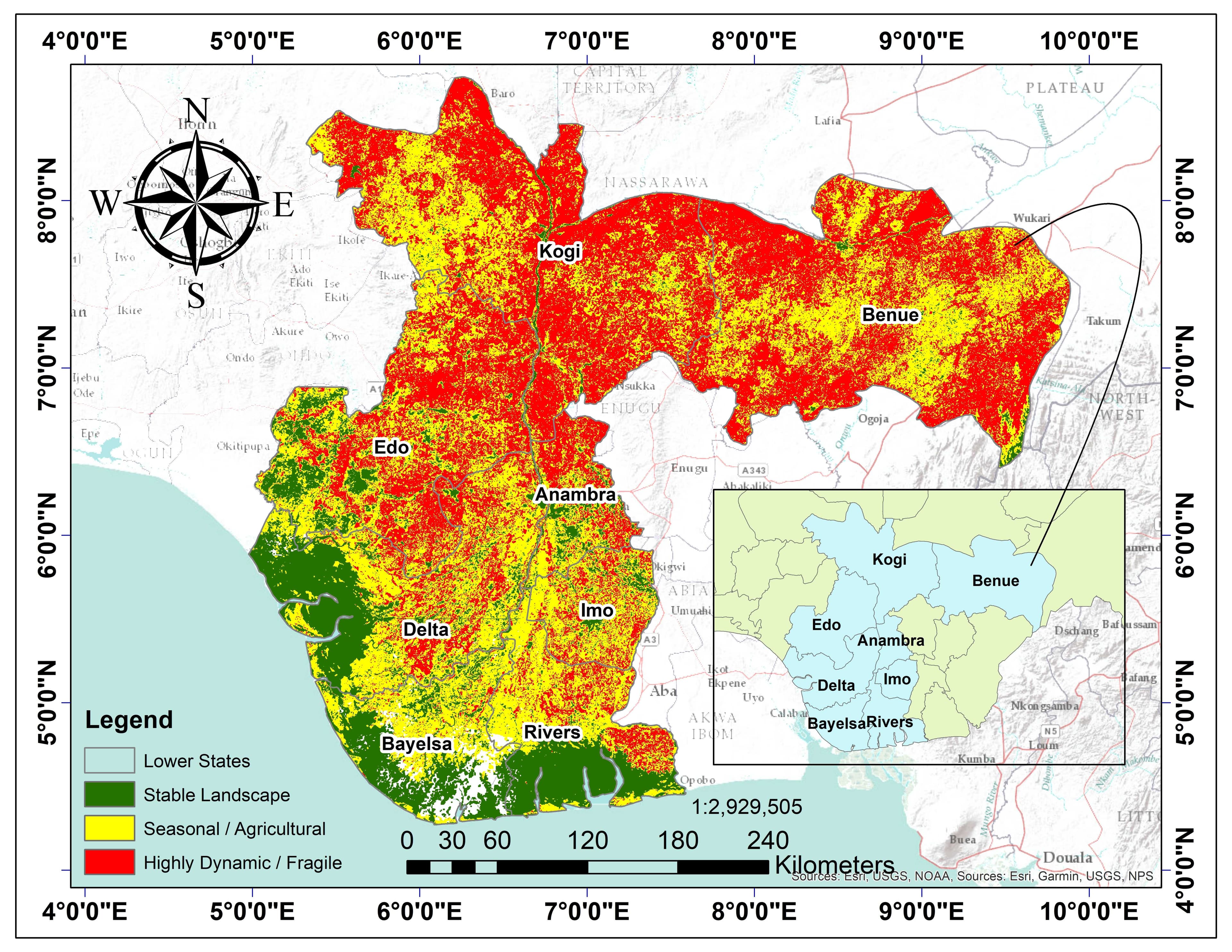
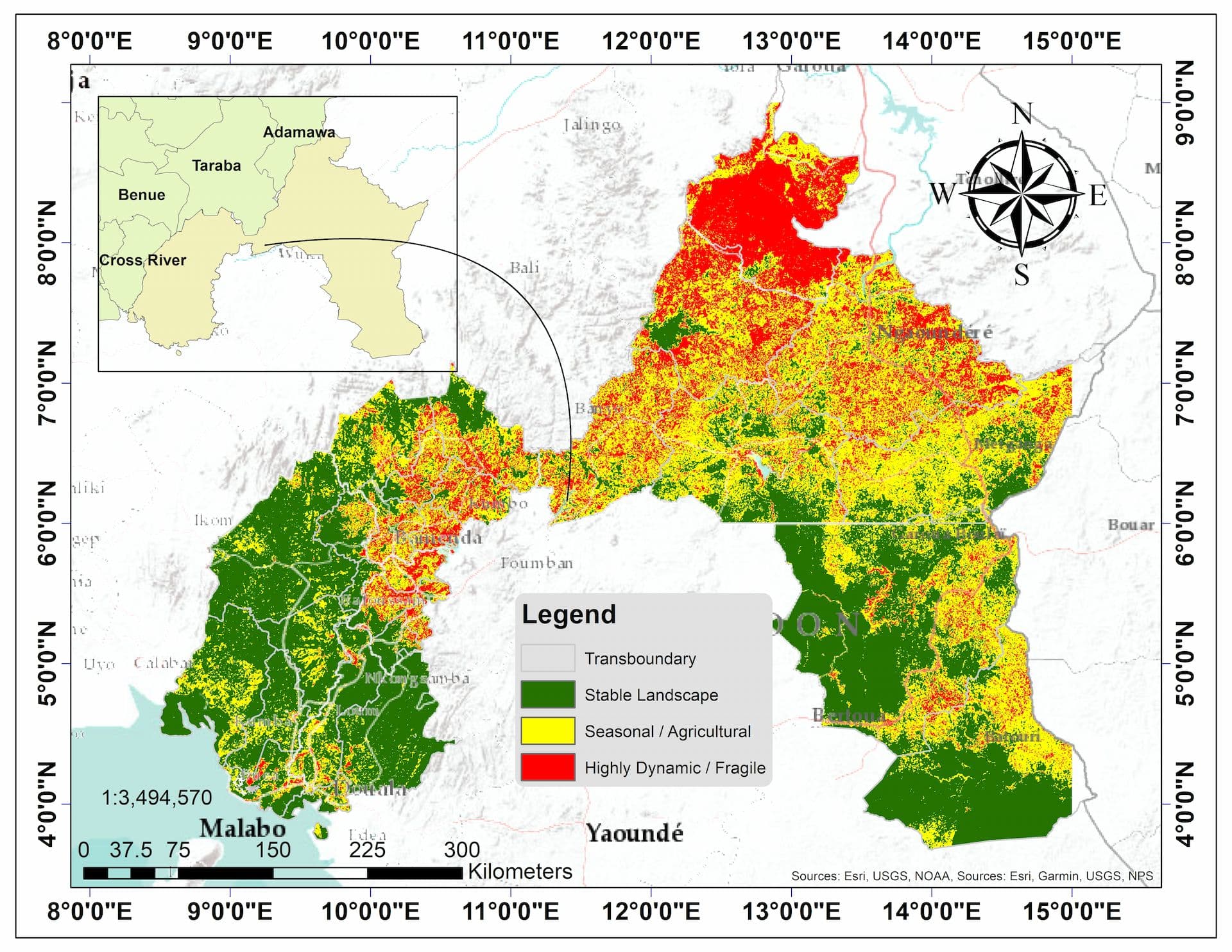
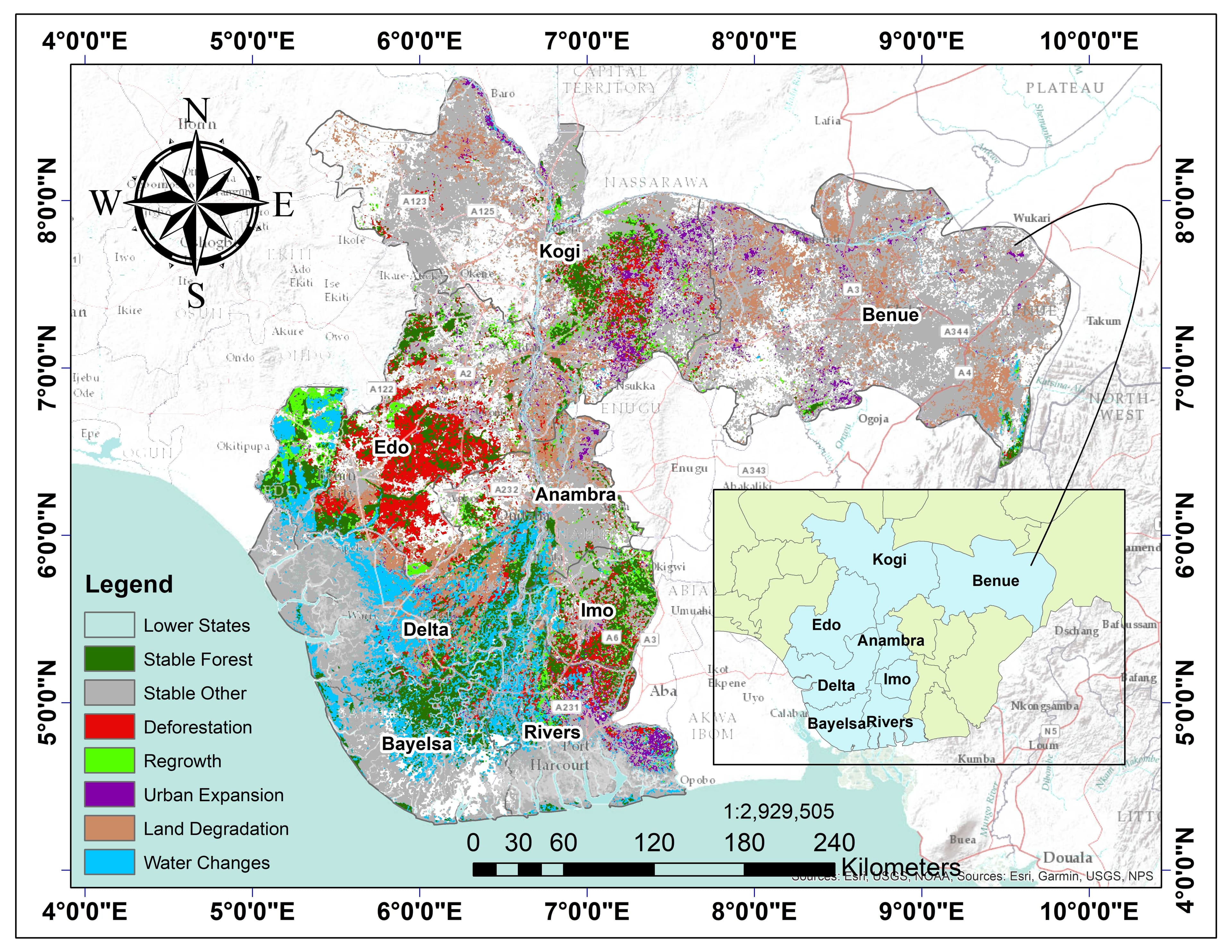
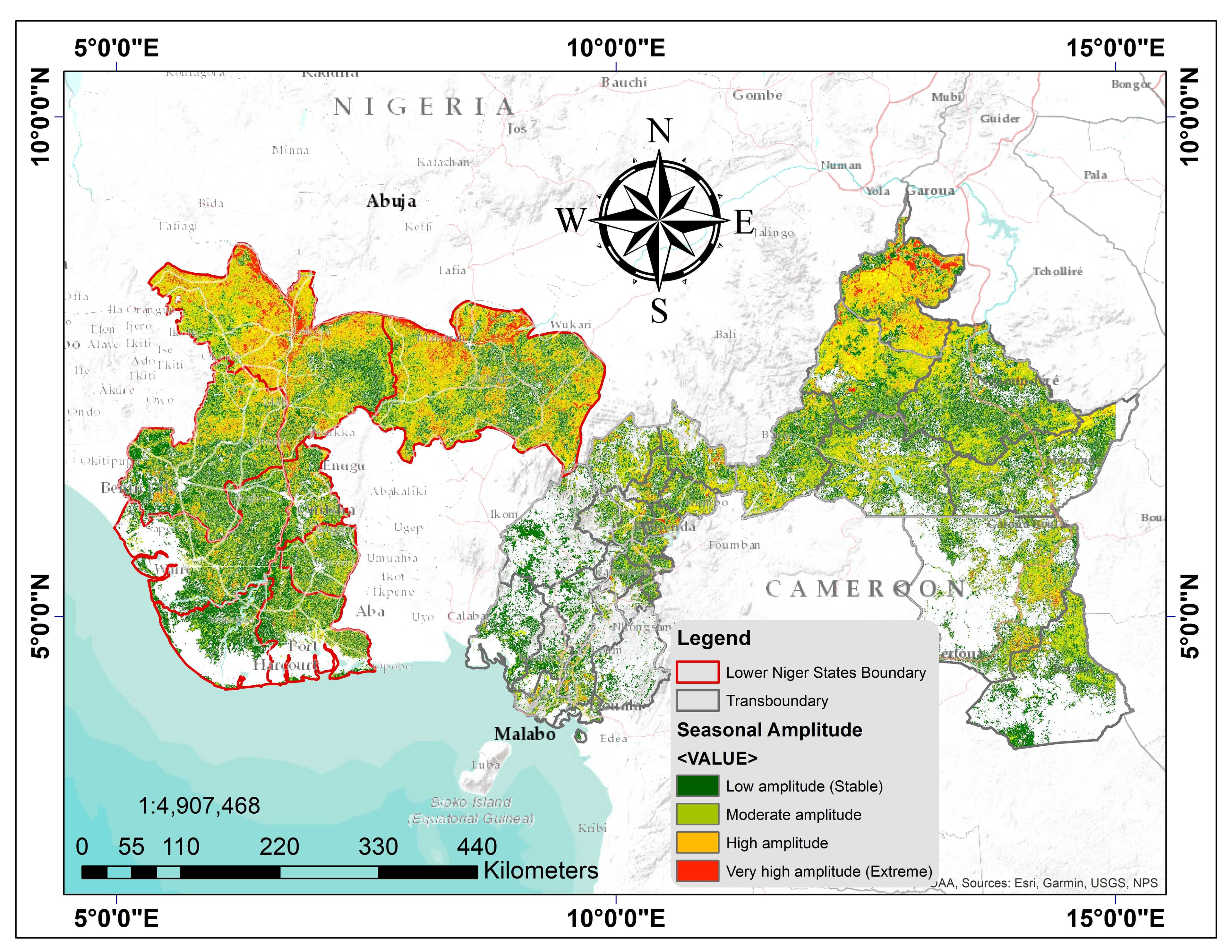
Lower Niger Basin Land Cover Dynamics & Flood Exposure Assessment (ACE WATER III Project)
A comprehensive 5‑year (2020–2025) geospatial assessment of land cover dynamics, flood exposure, and landscape stability across the Lower Niger Basin. Used Google Earth Engine, Landsat/Sentinel imagery, and machine learning to analyze deforestation, land degradation, urban expansion, and flood recurrence across 67.9 million hectares spanning Nigeria and Transboundary Cameroon. Findings revealed Nigeria has 11.7× more land degradation and 2× higher seasonal instability than Cameroon.
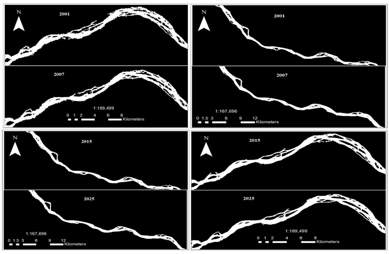
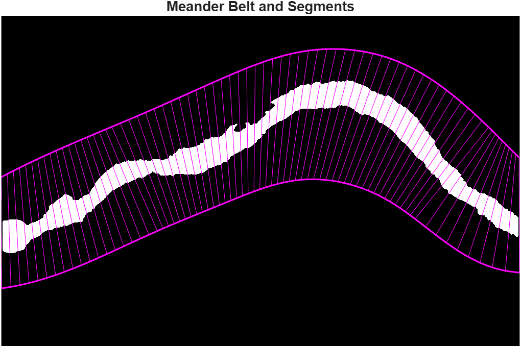
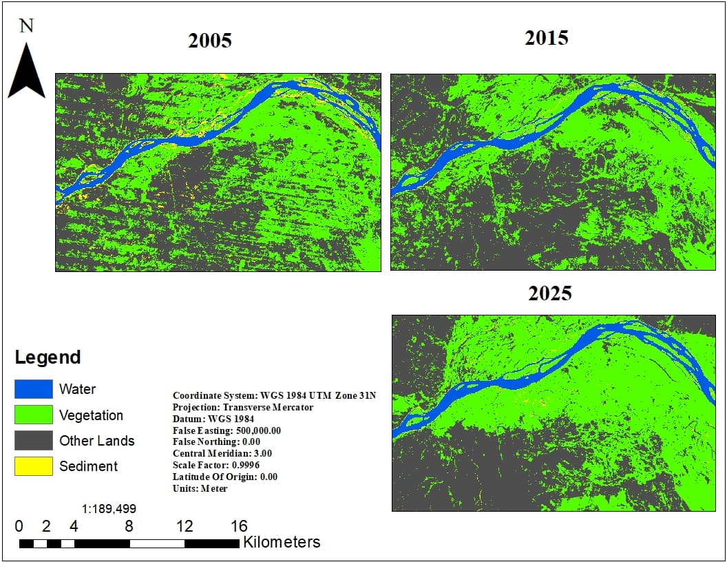

Niger River Morphodynamics: 25‑Year Analysis Using Landsat Time‑Series and Machine Learning
Developed an end-to-end workflow for analyzing 25 years (2001–2025) of Niger River morphodynamics using Google Earth Engine, Landsat time-series, Random Forest classification, and RivMAP. Extracted centerlines, channel widths, sinuosity, migration rates, and erosion/accretion patterns downstream of the Kainji-Jebba dam cascade.
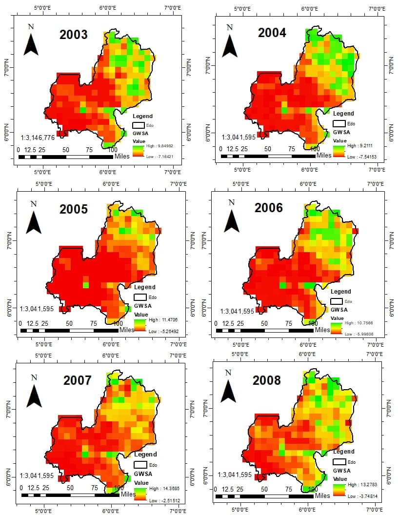
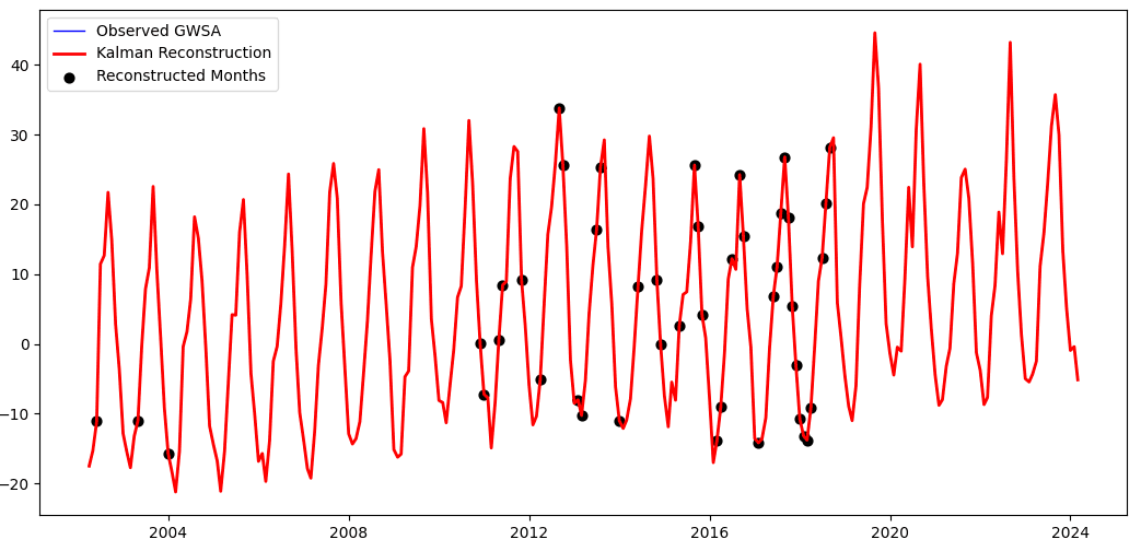
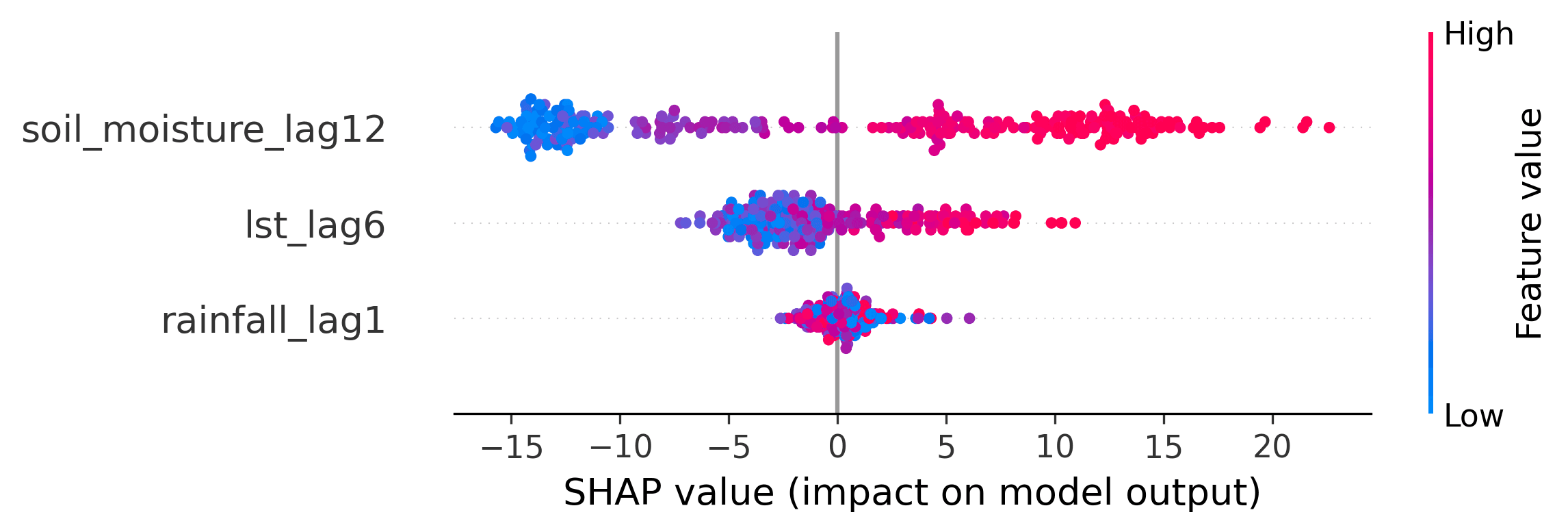
Groundwater Storage Anomaly Reconstruction Using GRACE/GRACE‑FO and Machine Learning
Developed an end-to-end Python workflow integrating GRACE/GRACE-FO, climatic, and environmental datasets to reconstruct missing groundwater observations, identify lagged hydrological controls, and downscale groundwater storage anomalies across Edo State using Random Forest and XGBoost (best cross-validated R² = 0.715).
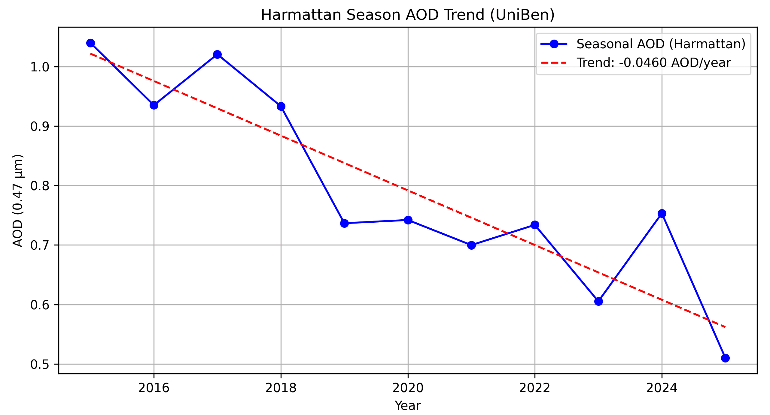
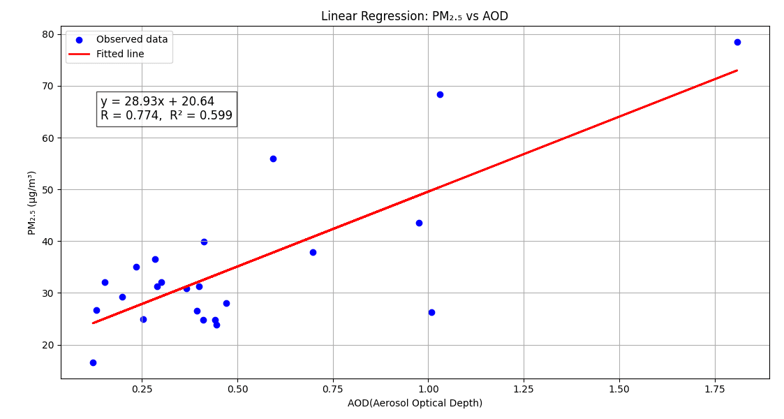
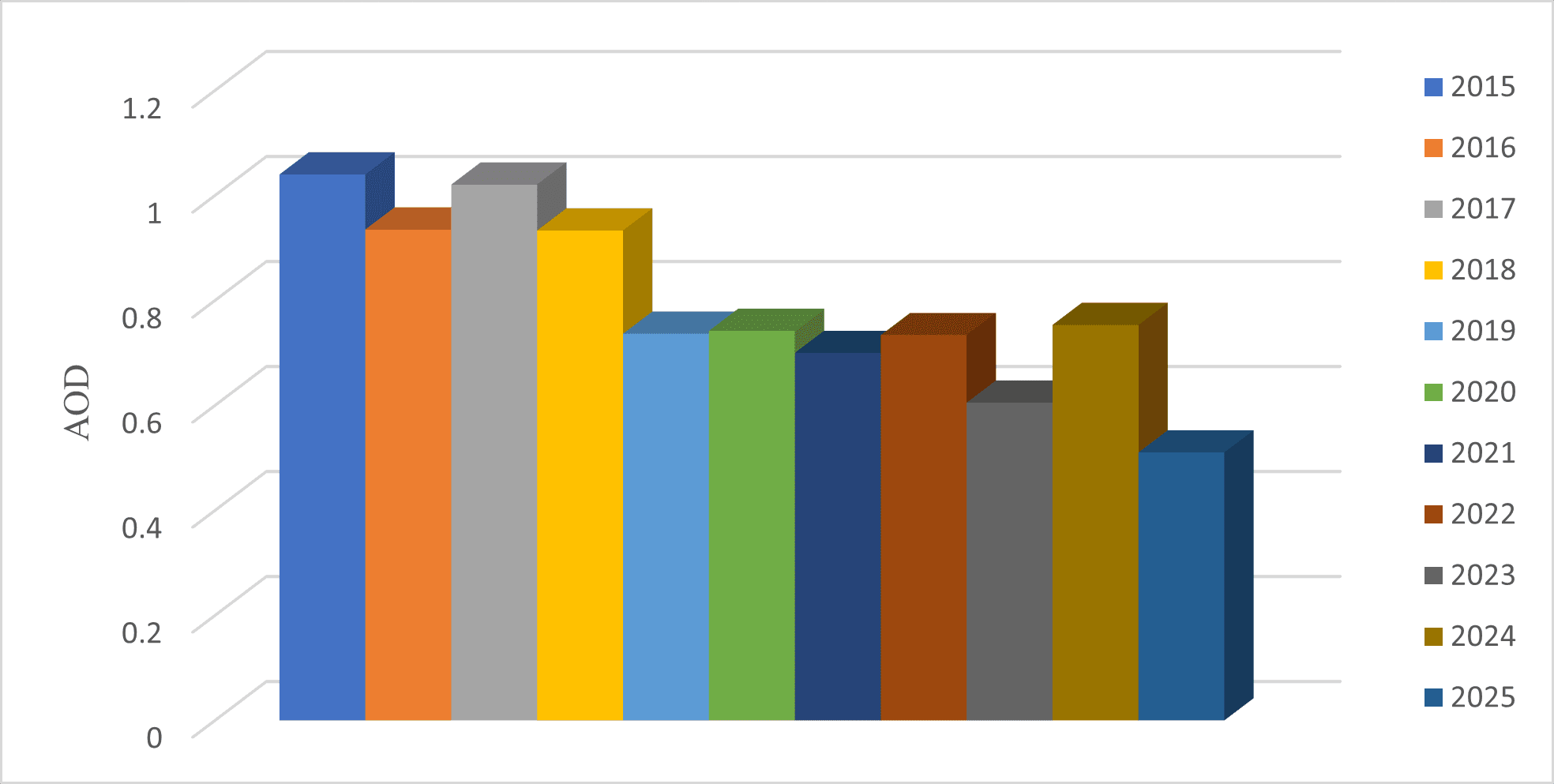
Satellite‑Based Air Quality Assessment Using MODIS MAIAC AOD and PM₂.₅ Observations
Processed and analyzed 10 years (2015–2024) of MODIS MAIAC aerosol data and ground-based PM₂.₅ observations using Google Earth Engine and Python to evaluate air-quality variability over the University of Benin. Developed and validated satellite-to-surface regression models linking aerosol optical depth (AOD) and PM₂.₅ concentrations.
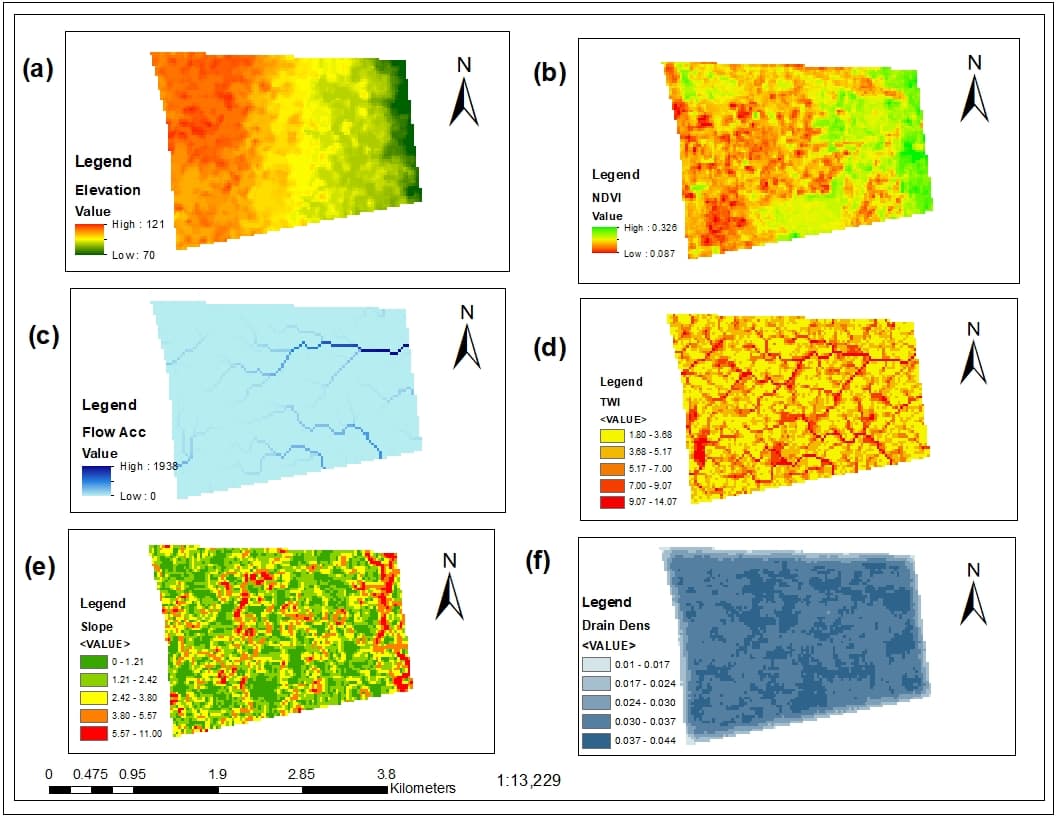
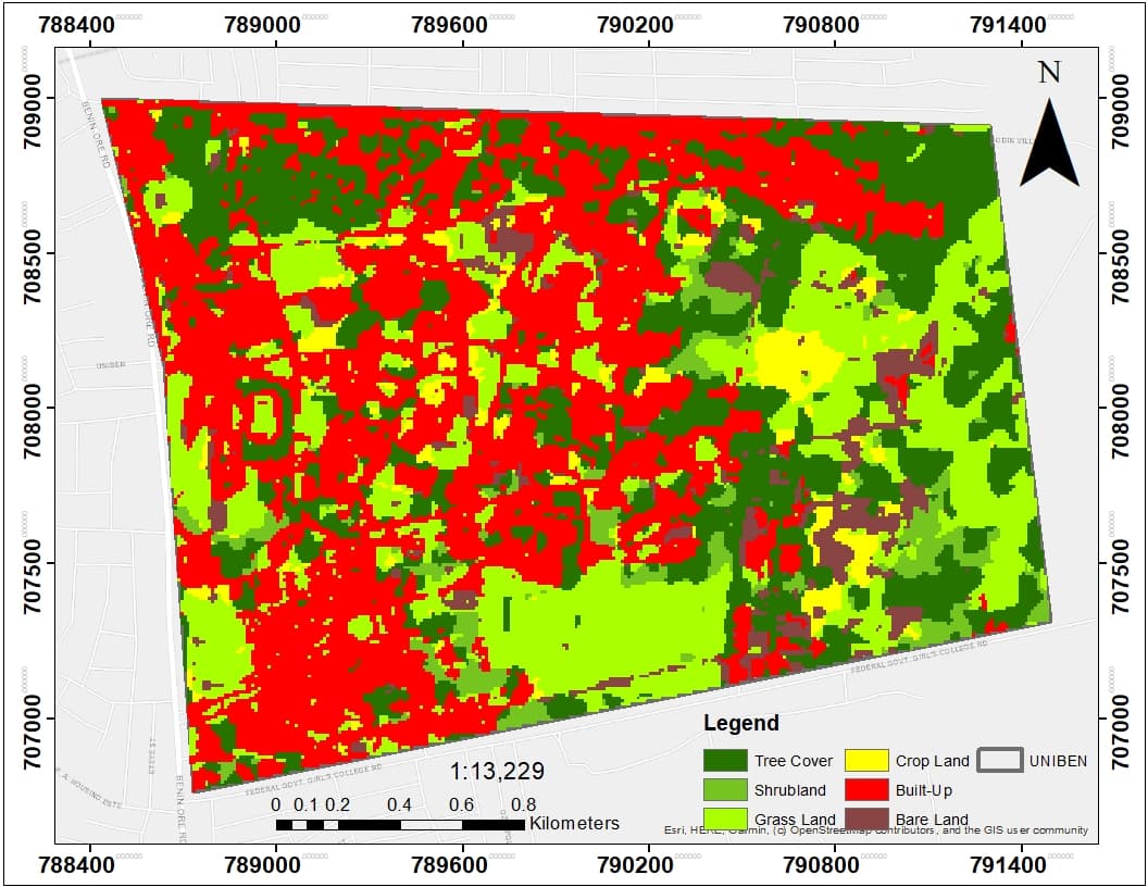
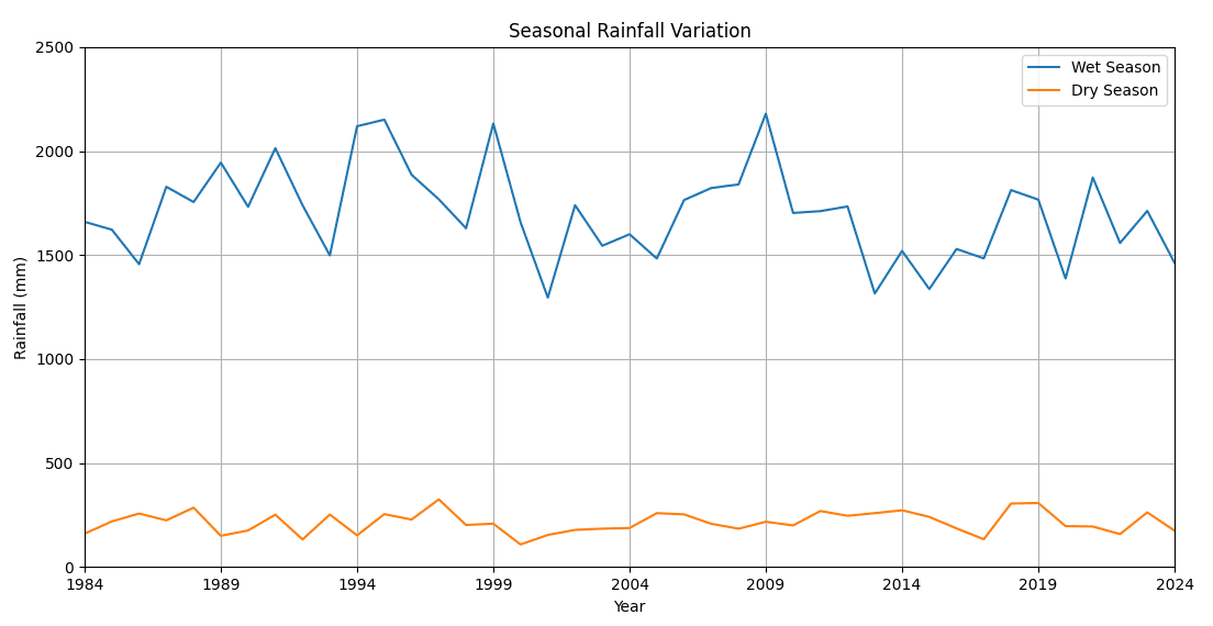
Flood Susceptibility Mapping Using GIS and Multi‑Criteria Decision Analysis
Developed a GIS-based flood susceptibility model integrating DEM-derived terrain factors, vegetation indices, land-cover information, and multi-criteria decision analysis (AHP) to identify flood-prone zones within the University of Benin. Integrated Sentinel-1 SAR and CHIRPS rainfall data.
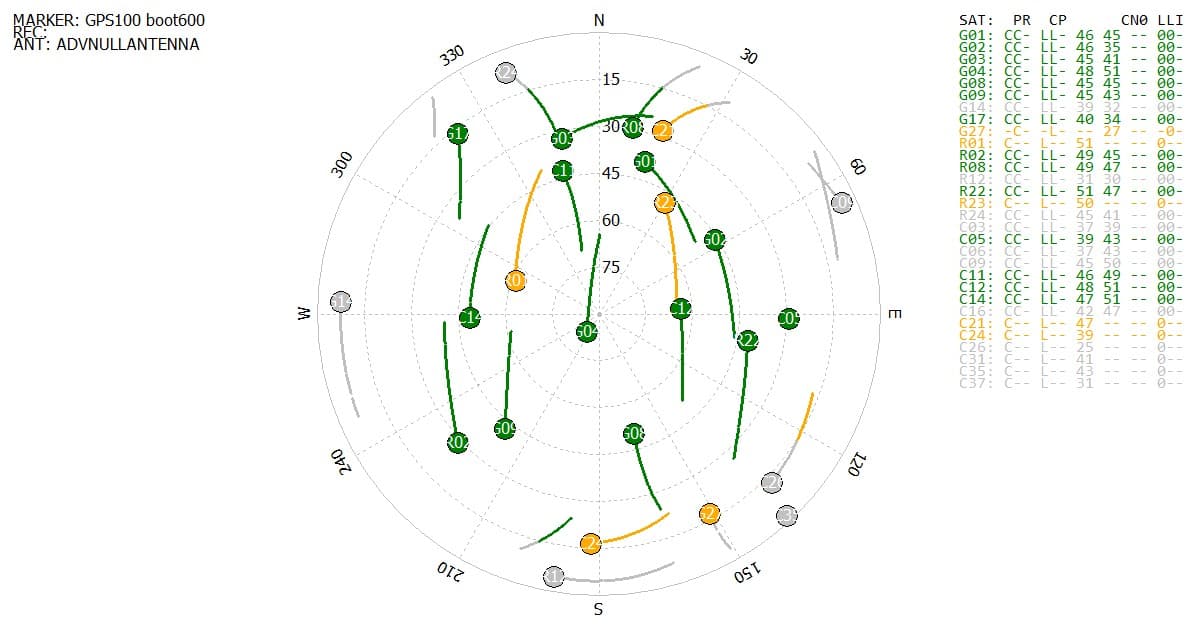
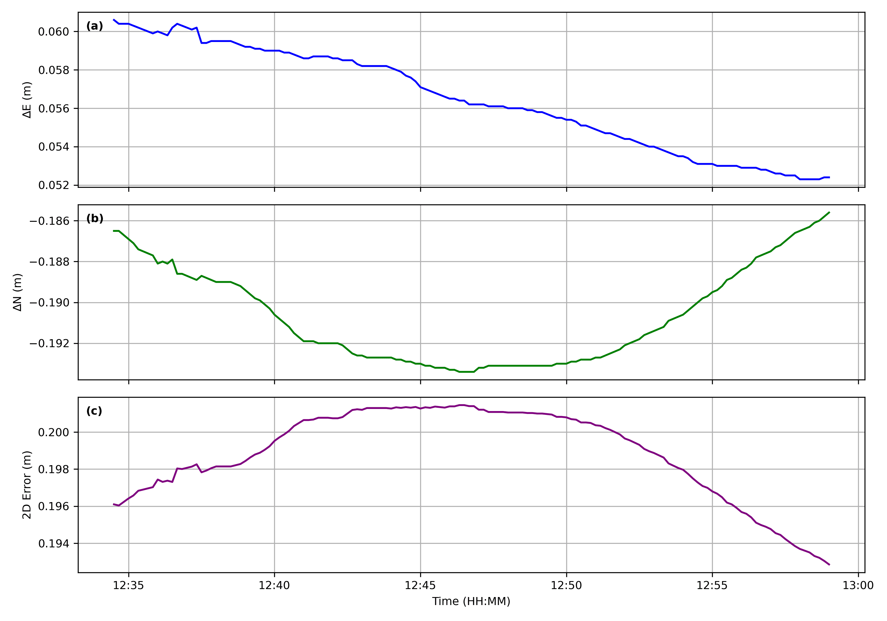
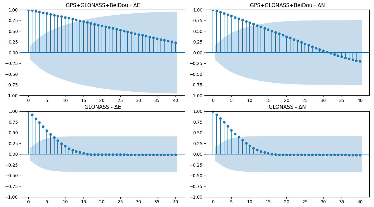
Multi‑Constellation GNSS Positioning Accuracy Assessment Using RTKLIB
Evaluated multi-constellation GNSS positioning accuracy using static observations at five known control points, comparing ambiguity resolution performance and positioning errors across GPS, GLONASS, and BeiDou solutions. Processed using RTKLIB and Tersus Geomatics Office.
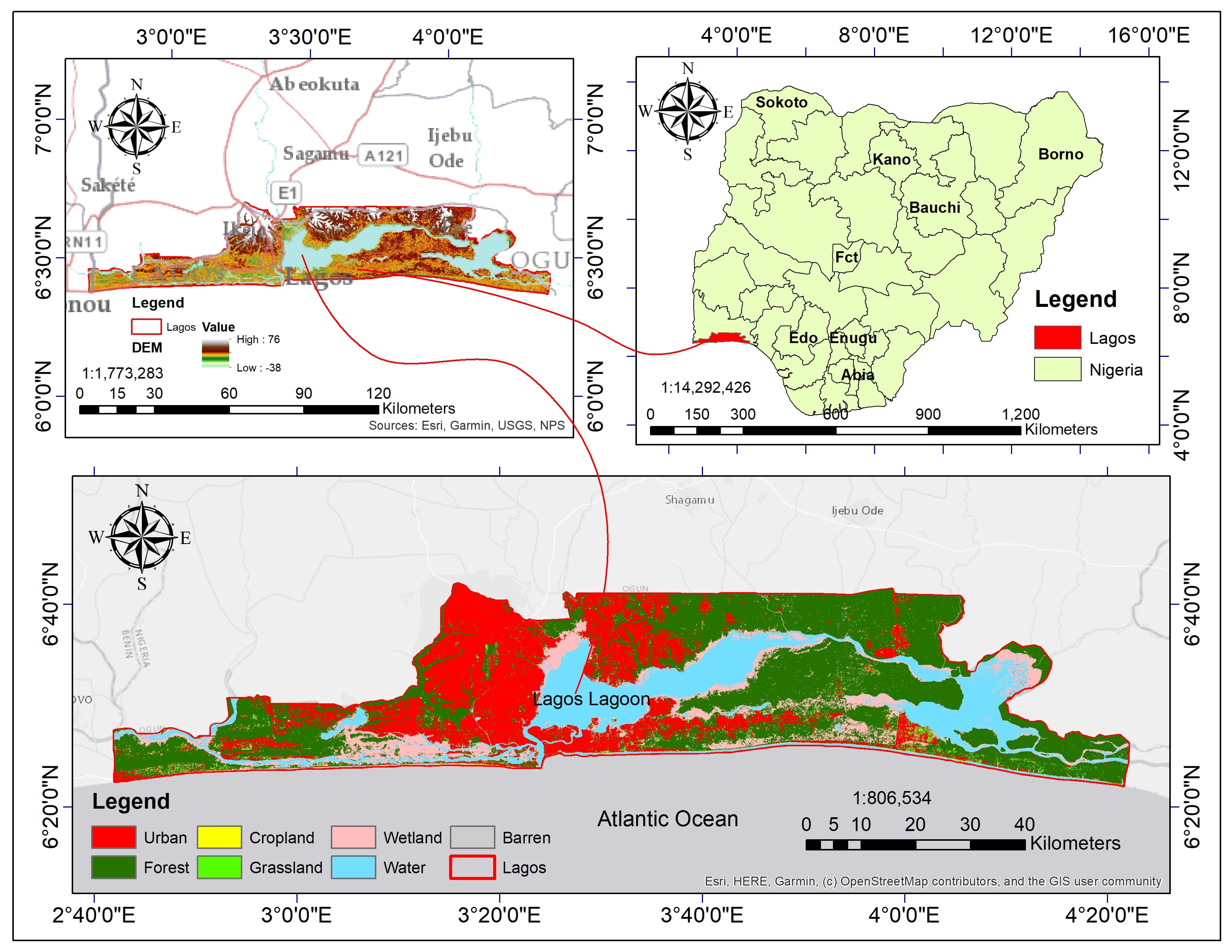
Hydrological Modeling of Land Use Change Impacts on Streamflow (University of Georgia Collaboration)
Leading satellite data acquisition and processing (precipitation, climate reanalysis, DEM, multi-temporal LULC, soil data) for SWAT hydrological modeling of land use change impacts on streamflow in the ungauged Lagos State, Nigeria. Assisting with model calibration using satellite evapotranspiration (GLEAM); co-authoring manuscript for journal publication.
My Projects
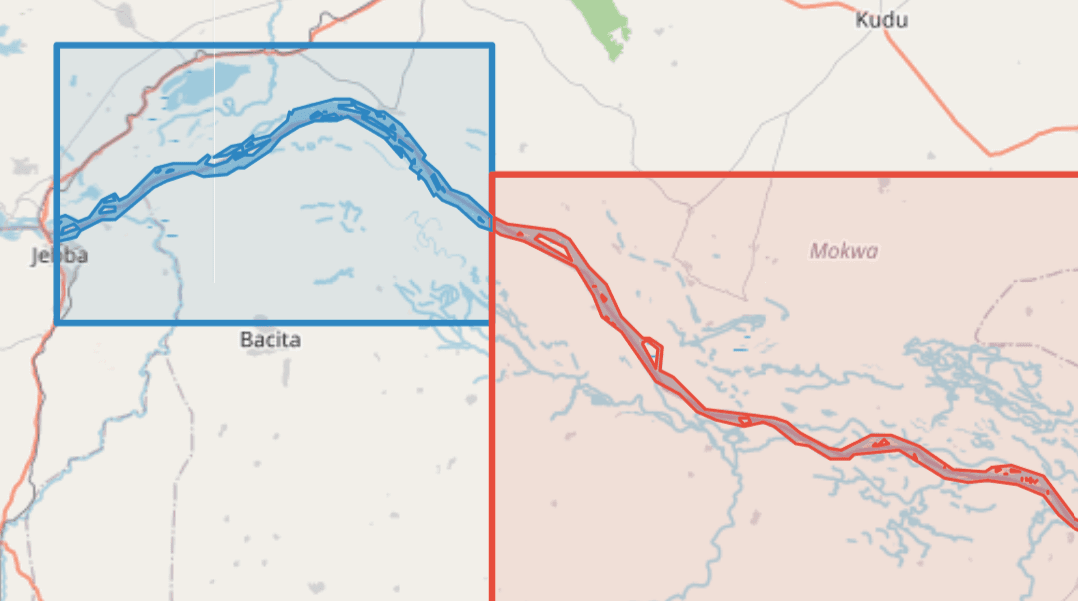
Niger River Morphodynamics Dashboard
An interactive dashboard visualizing 25 years of channel change in the Niger River downstream of the Kainji-Jebba dams, using 30-metre Landsat imagery, machine learning classification, and geomorphic extraction tools.
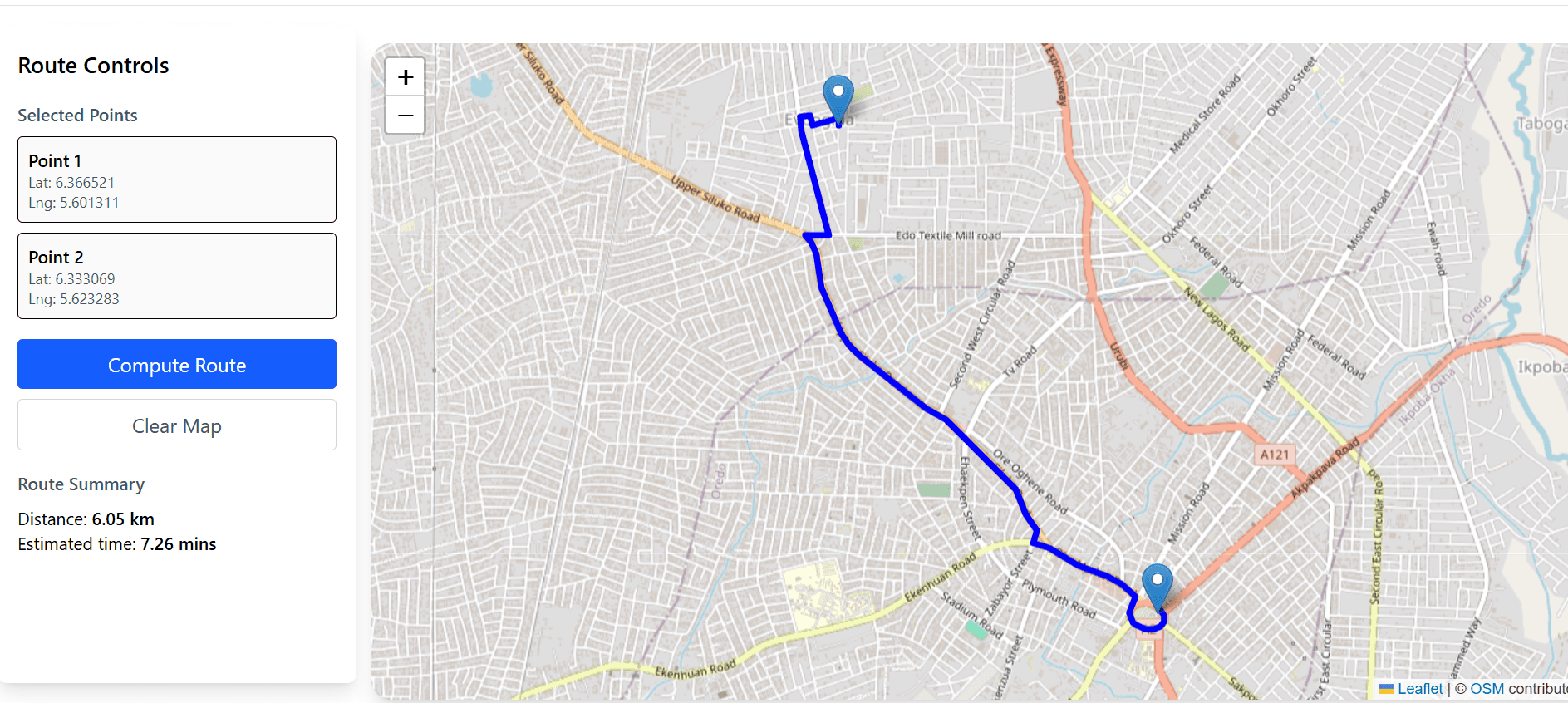
Route Optimization Web Application
A full-stack web application for logistics route optimization using open-source geospatial algorithms, Leaflet.js, and OpenRouteService API. Users can place start/end points on a map, view routes, and see distance and estimated travel time.
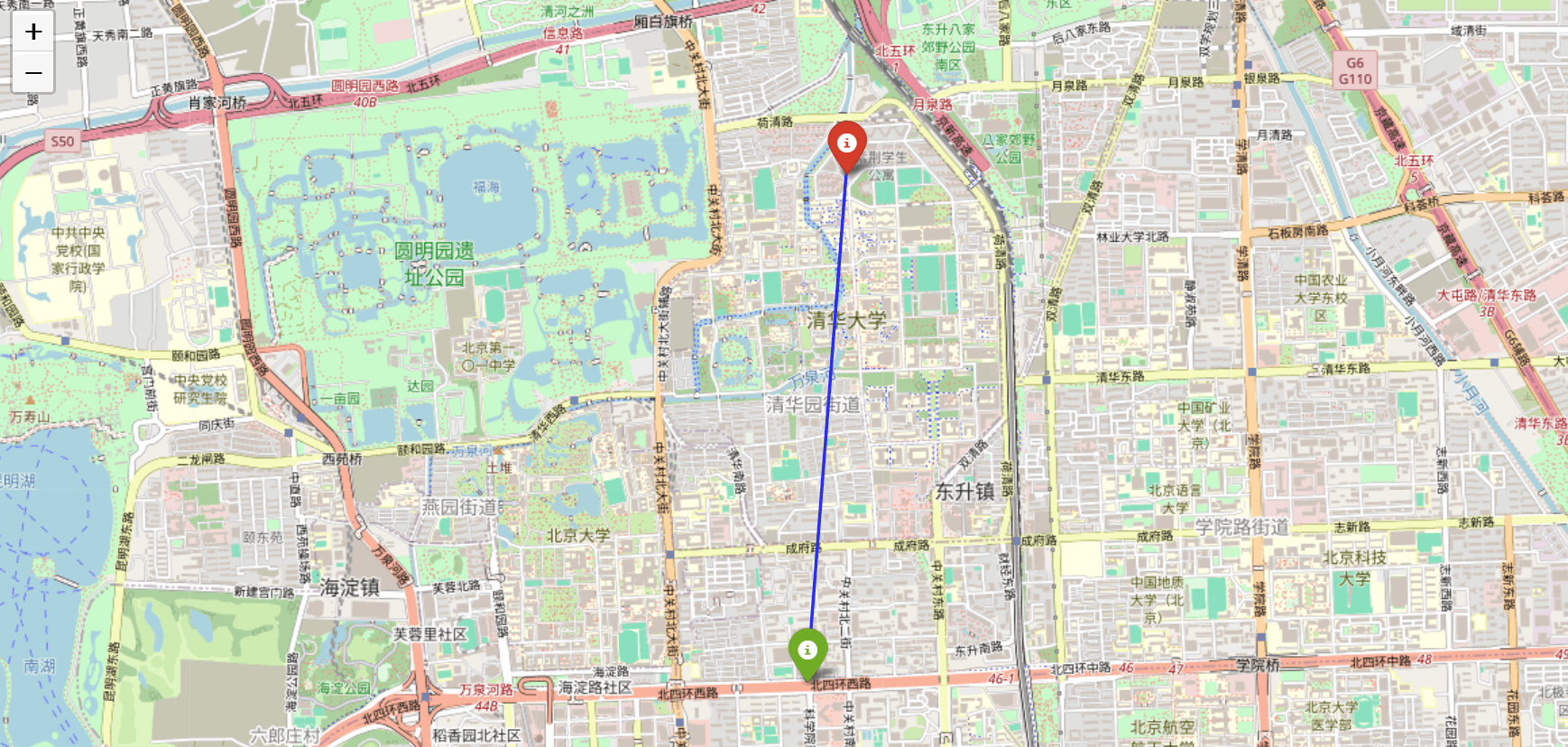
GeoAI Travel Time Prediction
Predicting actual travel time from GPS trajectories using Random Forest, Geolife dataset, and OpenRouteService comparison. Built with Python, scikit-learn, and geospatial analysis tools.
Google Earth Engine Binary Mask Extraction
GEE JavaScript code for extracting binary river masks from Landsat 4, 5, 7, 8 imagery (1985–2025). Includes cloud masking, band harmonization, spectral indices, Random Forest classification, and mask export for morphodynamic analysis.
RivMAP River Morphodynamics
MATLAB scripts using the RivMAP toolbox to analyze multi-year binary river masks. Extracts centerlines, channel widths, sinuosity, curvature, migration rates, erosion/accretion patterns, and cutoffs.
Research Partners
Organizations and institutions that have funded or supported my research

European Union
Visit Website →Funded the ACE WATER III Project – a basin-scale environmental and flood-risk assessment across the Lower Niger River Basin using Landsat, Sentinel-1 SAR, CHIRPS rainfall, and DEM datasets.

TETFund (Tertiary Education Trust Fund)
Visit Website →Supported research on satellite-based air quality assessment using MODIS MAIAC aerosol data and PM₂.₅ observations, as well as GIS-based flood susceptibility mapping at the University of Benin.