

A curated look at my work across industry, research, and volunteering. My background blends hands-on technical experience with an academic approach to problem-solving, alongside a dedication to applying those skills where they’re needed most. Explore the projects below to see how these different perspectives come together.

Industrial Experience
My professional journey and contributions to meaningful projects

Co-Founder & Lead Frontend Developer
HyperloopFT
Co-founded and led frontend development for three core products including Eyuwa (community platform), Venus Chain, and FraudWatch. Built and maintained web applications using React.js, Next.js, and TypeScript in a collaborative startup environment.



Key Responsibilities
- Architected and built responsive web applications using React.js, Next.js, and TypeScript
- Led frontend development workflows and collaborated using Git/GitHub version control
- Managed cross-functional collaboration with designers and backend developers
- Implemented modern UI/UX patterns and optimized application performance
Key Achievements
- ●Successfully deployed three production-ready web applications
- ●Built scalable frontend architecture supporting multiple products
- ●Delivered high-quality, maintainable code with modern best practices
Geomatics Intern
Sacredion Nigeria Limited
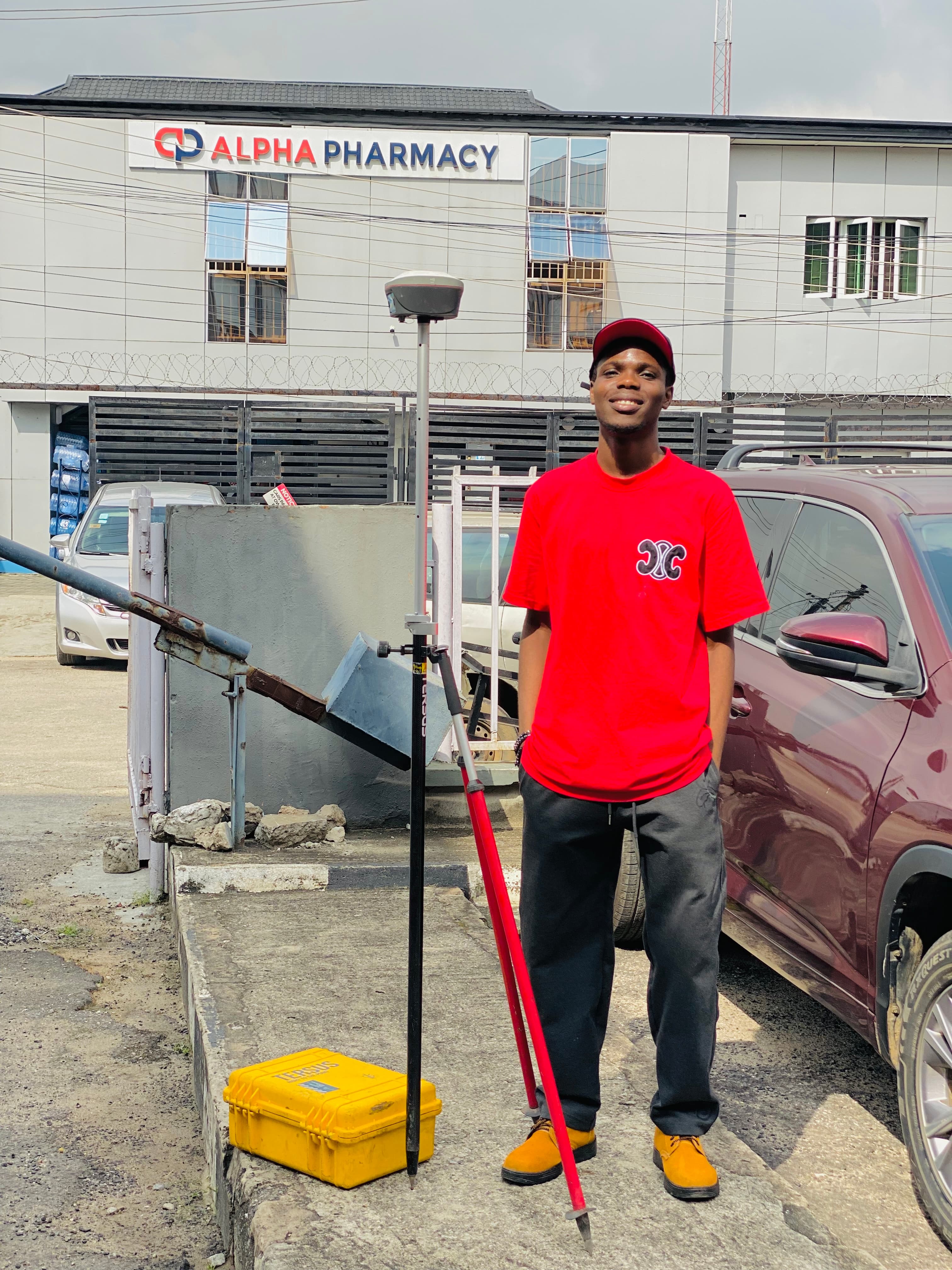
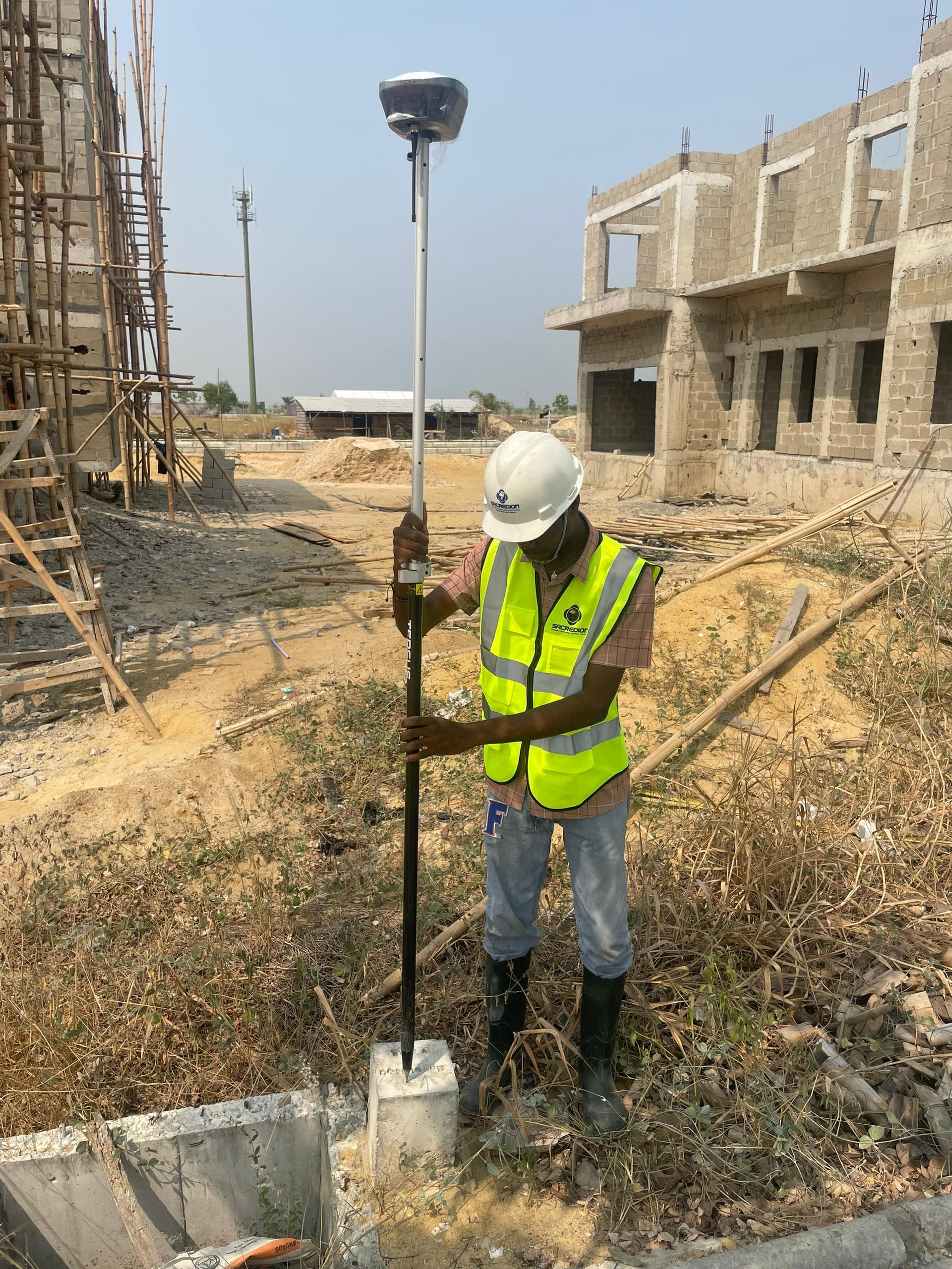
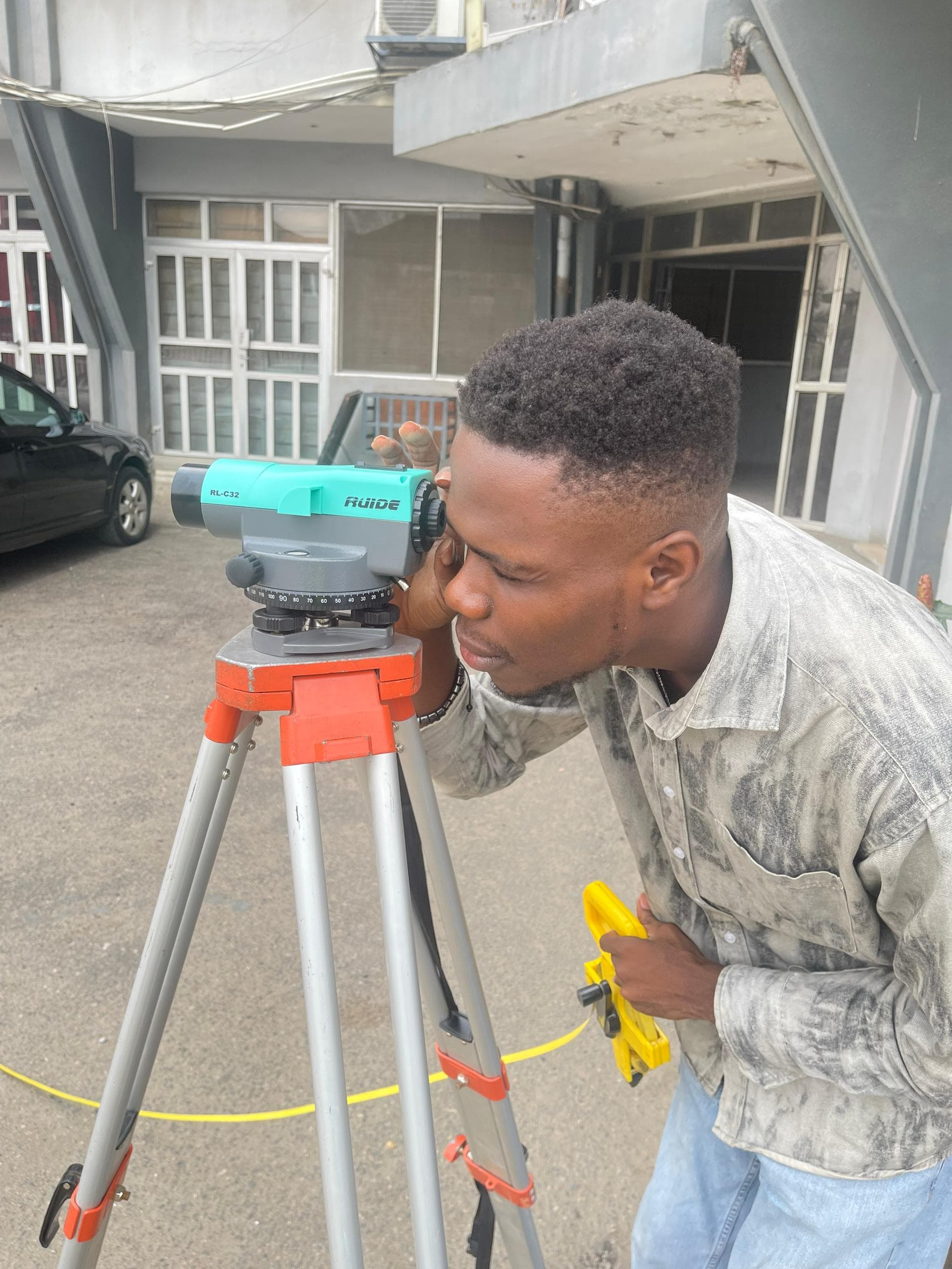
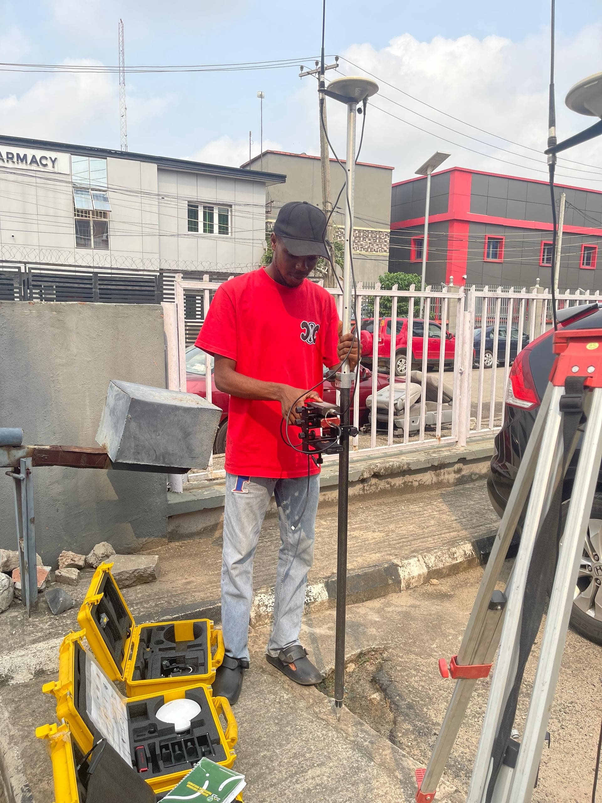
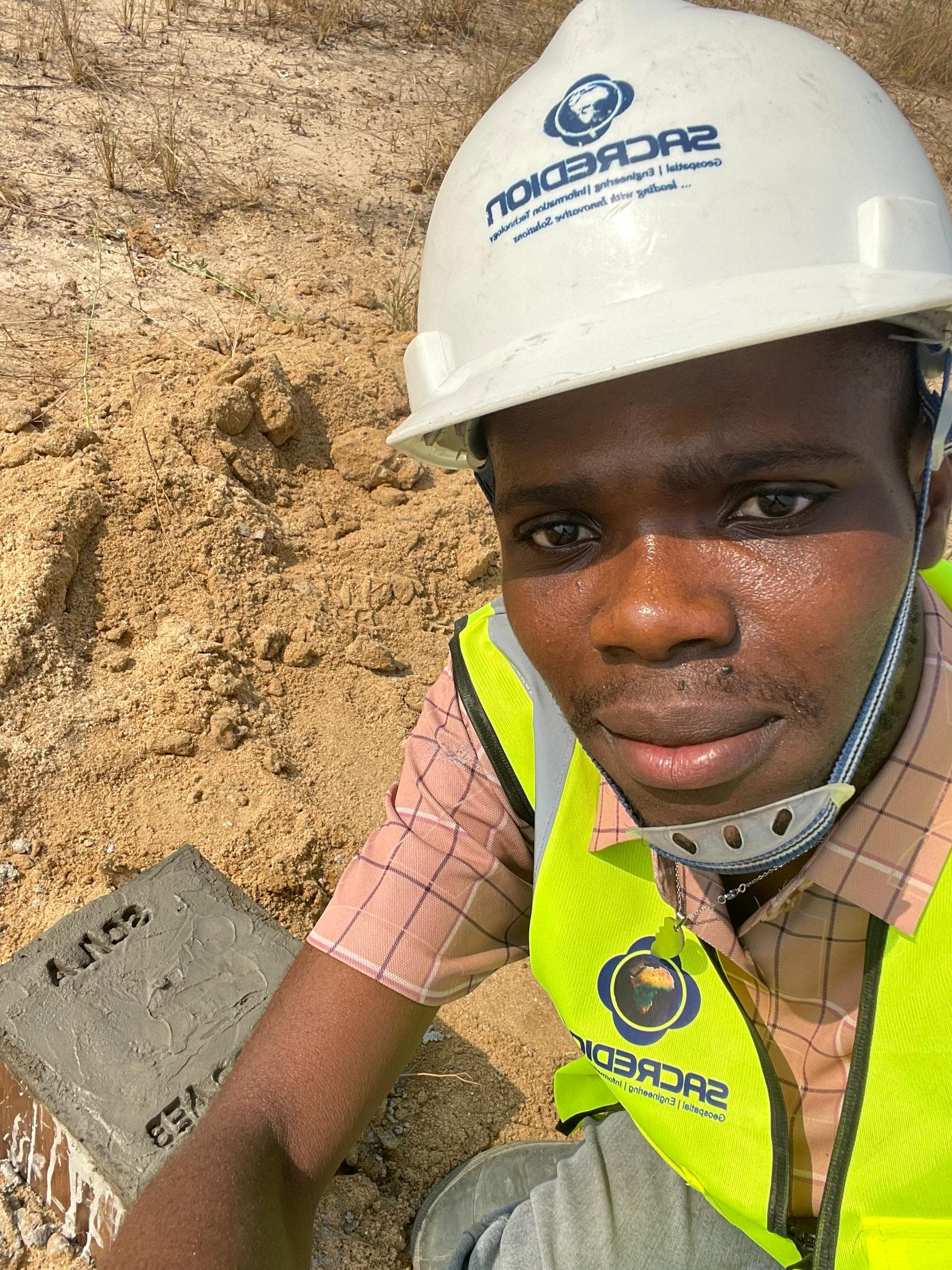
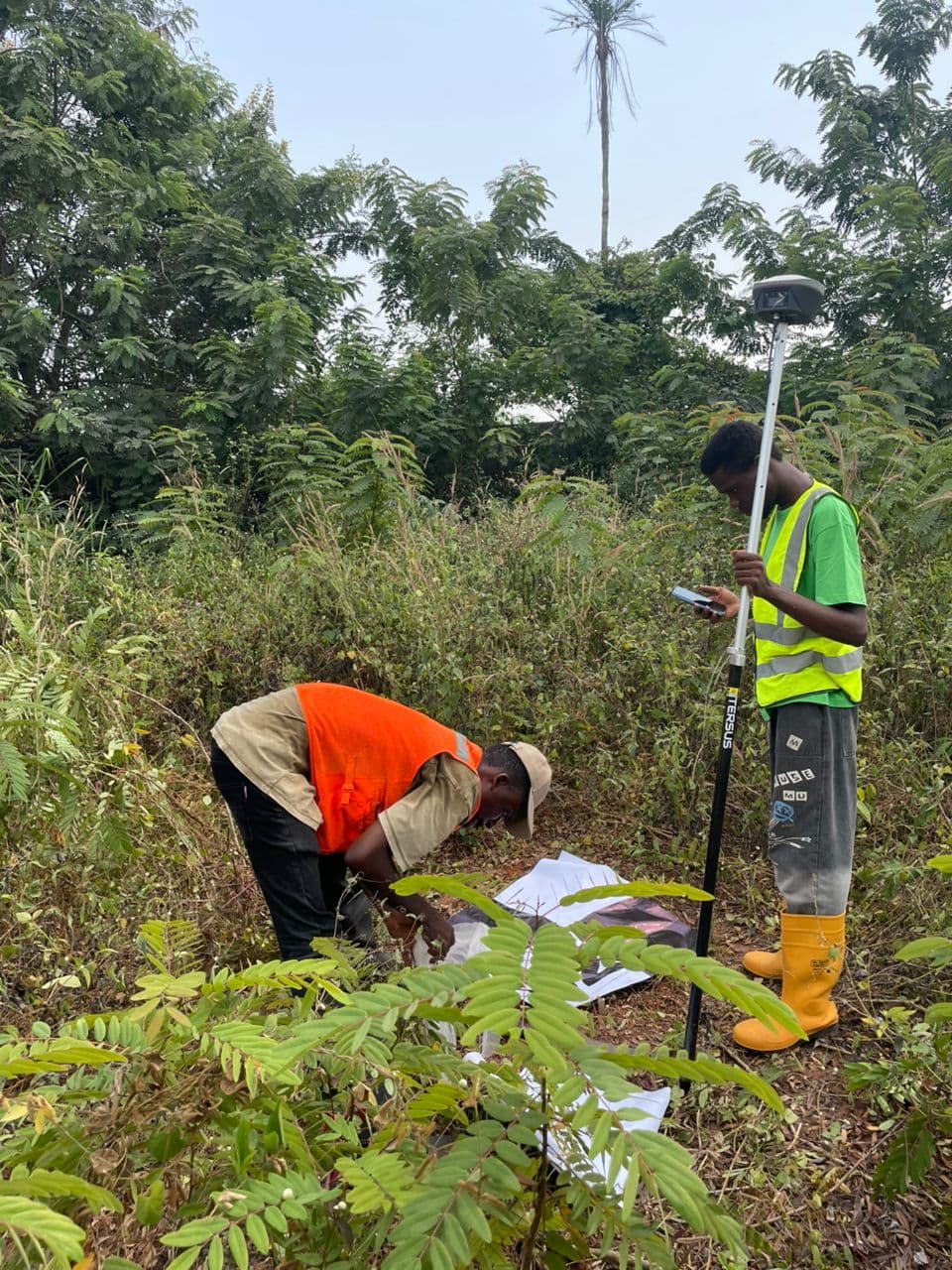
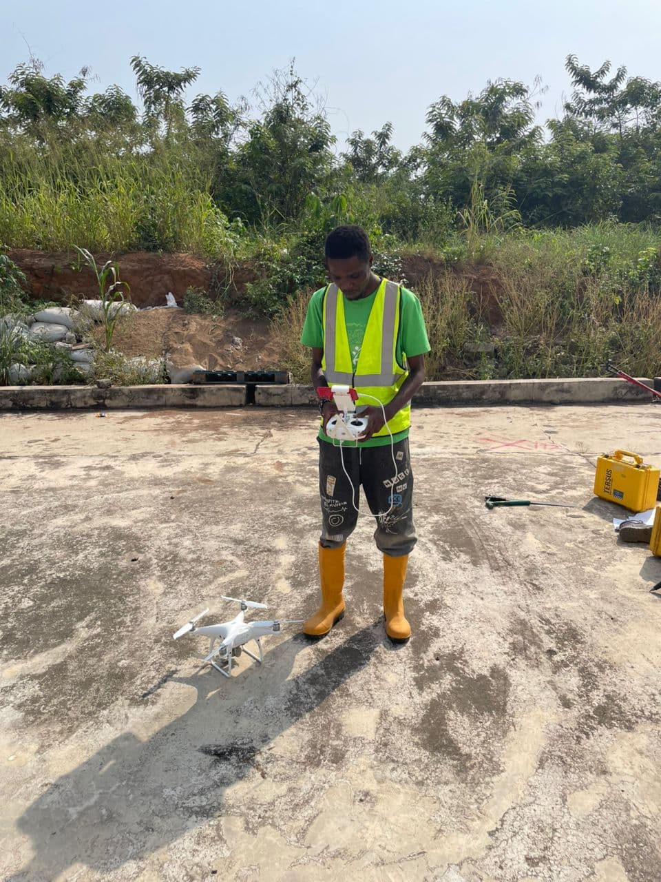
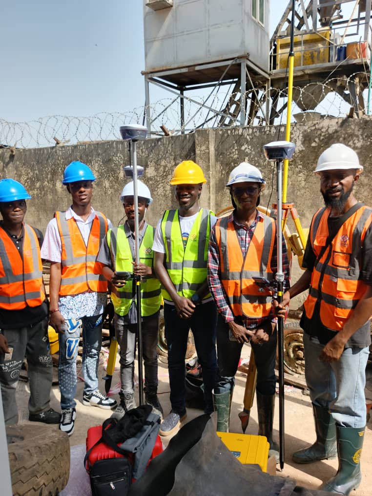
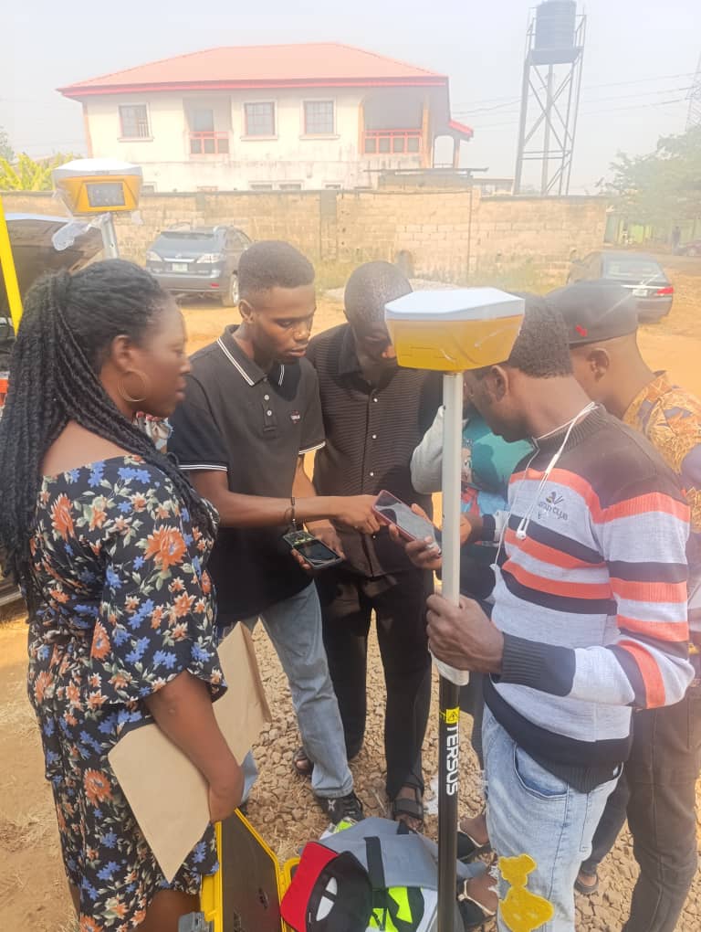
Conducted cadastral and topographic surveys using Tersus GNSS receivers (static and RTK methods). Processed GNSS observations to achieve centimetre-level positioning accuracy. Supported aerial mapping by establishing Ground Control Points (GCPs) and participated in geodetic control pillar establishment.
Key Responsibilities
- Conducted cadastral and topographic surveys using Tersus GNSS receivers (static and RTK methods)
- Processed GNSS observations to achieve centimetre-level positioning accuracy
- Established 25 Ground Control Points (GCPs) for drone-based orthophoto and DEM generation
- Participated in geodetic control pillar establishment for referencing at Grace Field Island, Lekki Phase 1
- Assisted in GNSS equipment deployment and trained surveyors across Lagos, Ondo, and Oyo States
Key Achievements
- ●Achieved centimetre-level positioning accuracy in GNSS observations
- ●Successfully trained surveyors across multiple states
- ●Supported aerial mapping operations with precise GCP establishment

Research Experience
Exploring how satellite data, machine learning, and hydroinformatics can help us understand and protect our environment.

Research Collaborator
University of Georgia – Earth Systems & Resources (ESR) Laboratory
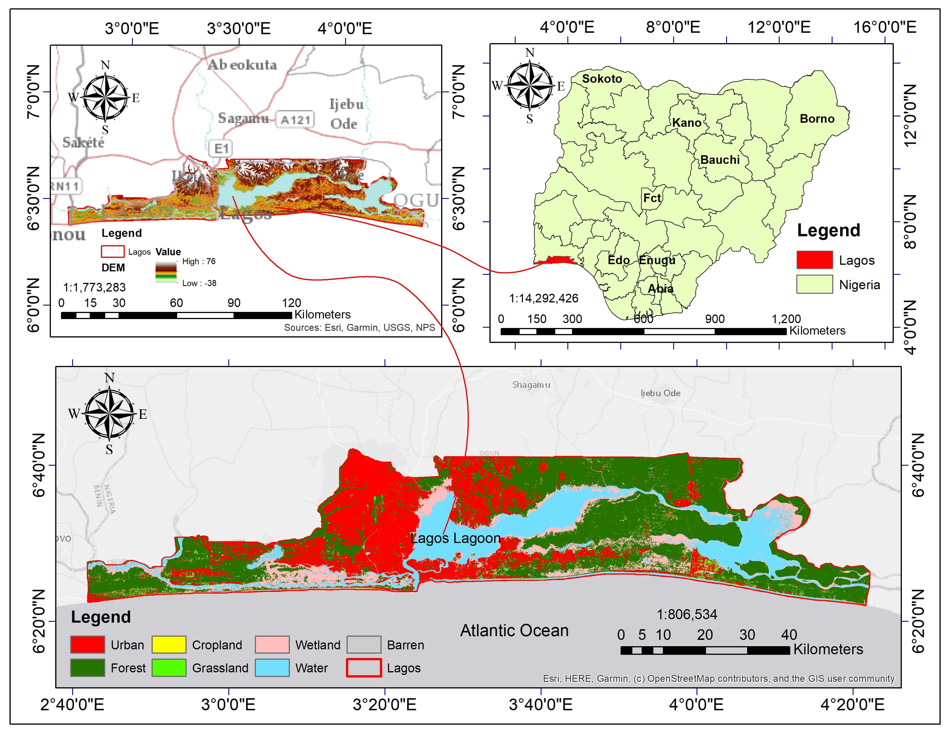
Leading satellite data acquisition and processing (precipitation, climate reanalysis, DEM, multi-temporal LULC, soil data) for SWAT hydrological modeling of land use change impacts on streamflow in ungauged Lagos State, Nigeria. Assisting with model calibration using satellite evapotranspiration (GLEAM); co-authoring manuscript for journal publication.
Key Responsibilities
- Leading satellite data acquisition and processing for SWAT hydrological modeling
- Processing precipitation, climate reanalysis, DEM, LULC, and soil datasets
- Assisting with model calibration using satellite evapotranspiration (GLEAM)
- Co-authoring manuscript for journal publication
Key Achievements
- ●Established robust data processing pipeline for ungauged watershed analysis
- ●Contributing to peer-reviewed publication on hydrological modeling
Research Assistant – ACE WATER III Project
University of Benin – European Union African Network of Centres of Excellence
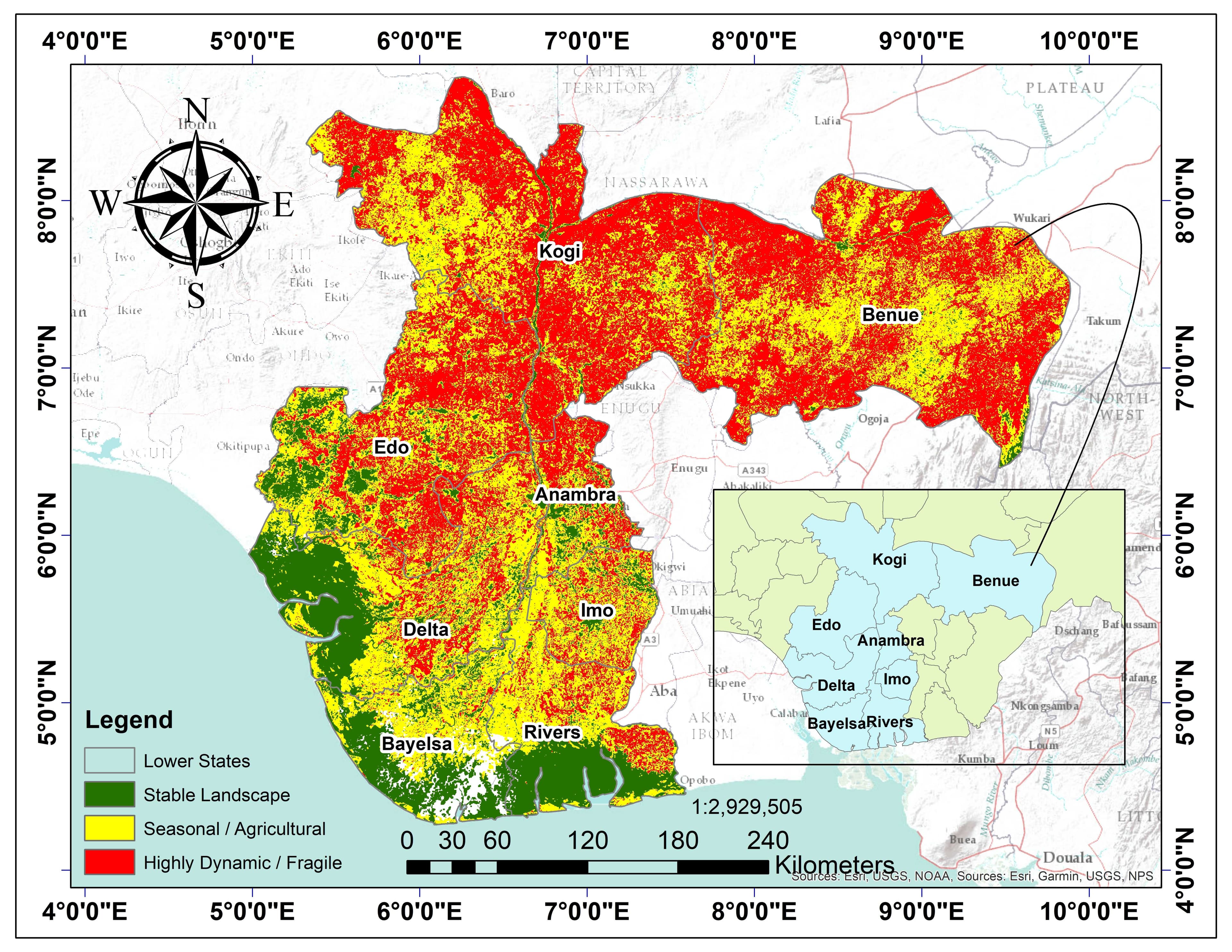
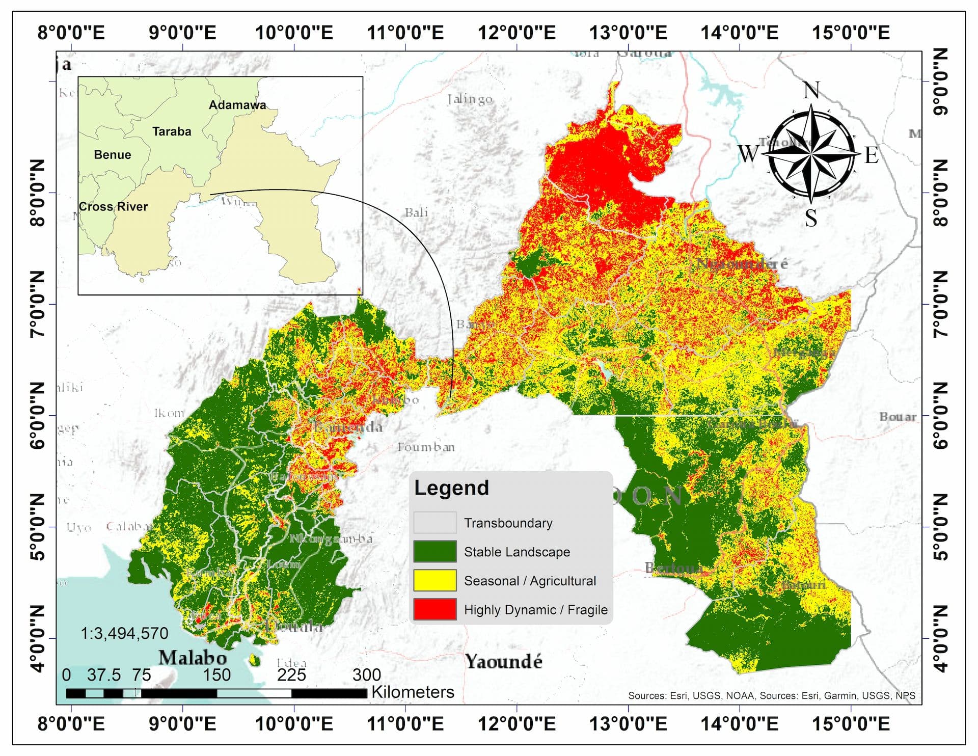
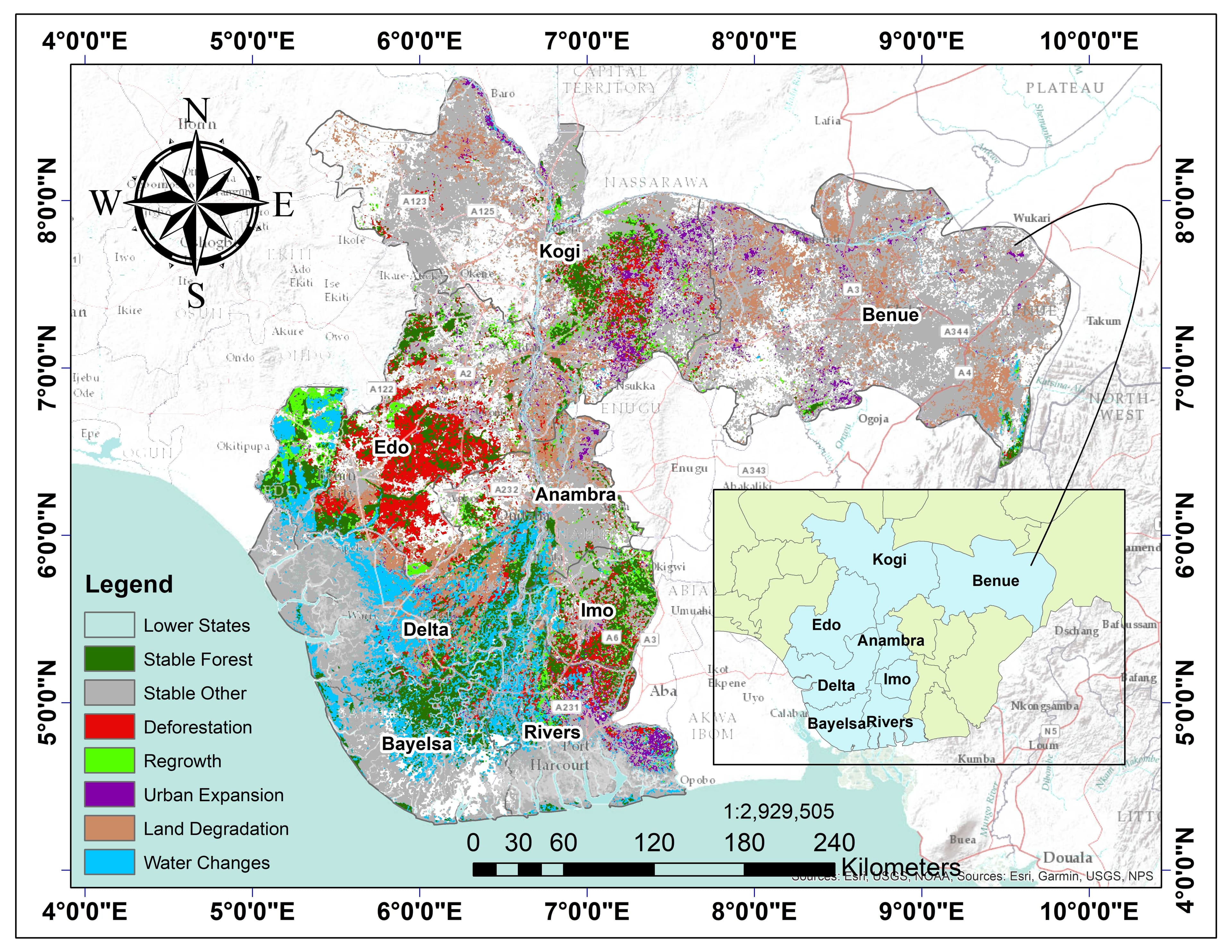
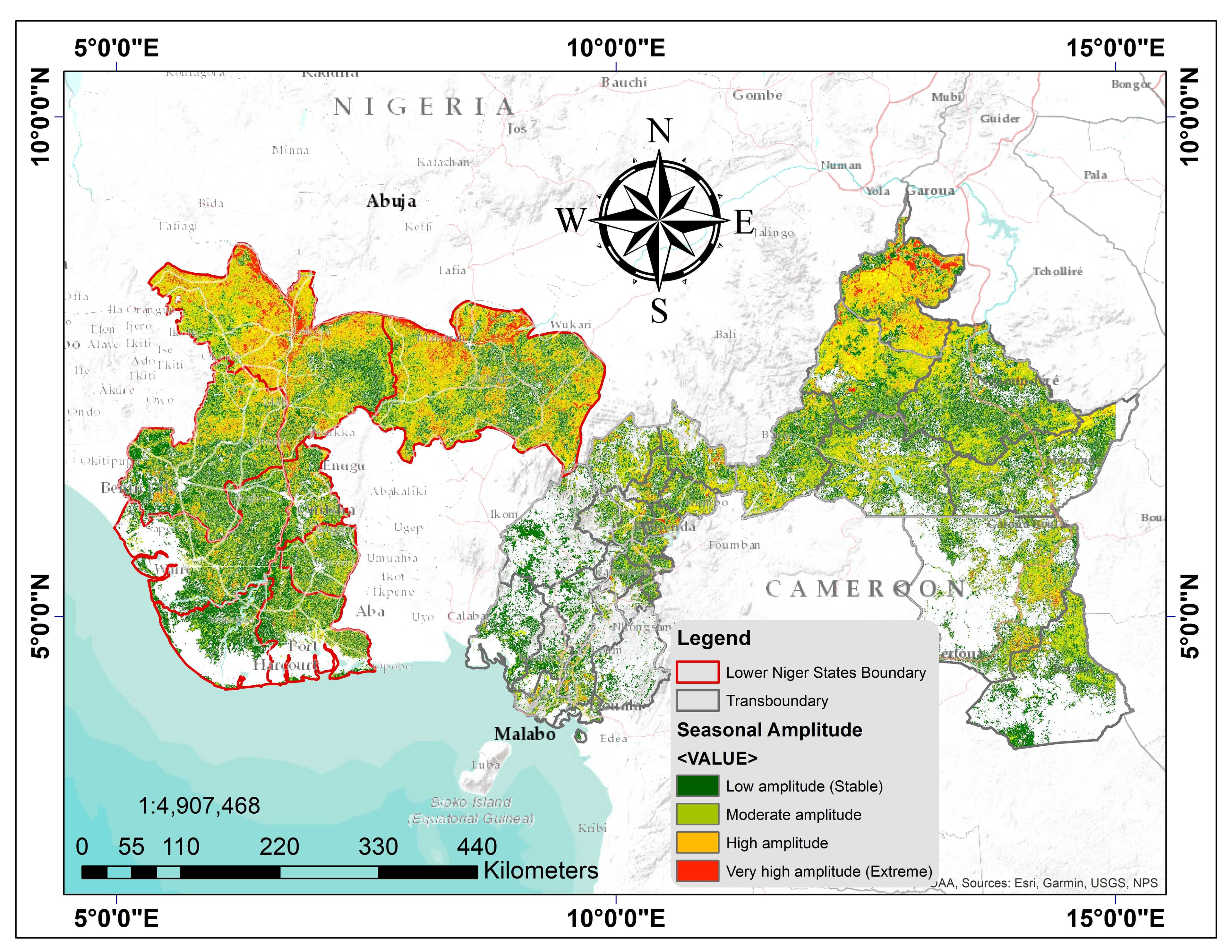
Supporting basin-scale environmental and flood-risk assessment across the Lower Niger River Basin using Landsat, Sentinel-1 SAR, CHIRPS rainfall, and DEM datasets. Conducting terrain and hydrological modelling, flood mapping, land-cover classification, and rainfall variability analysis using Google Earth Engine, ArcGIS, and Python.
Key Responsibilities
- Conducting terrain and hydrological modelling across the Lower Niger River Basin
- Flood mapping and land-cover classification using Landsat and Sentinel-1 SAR
- Rainfall variability analysis using CHIRPS datasets
- Processing geospatial data using Google Earth Engine, ArcGIS, and Python
Key Achievements
- ●Contributed to basin-scale environmental assessment across 67.9 million hectares
- ●Developed reproducible workflows using GEE and Python

Research Assistant – TETFund Project
University of Benin – Department of Geomatics Engineering
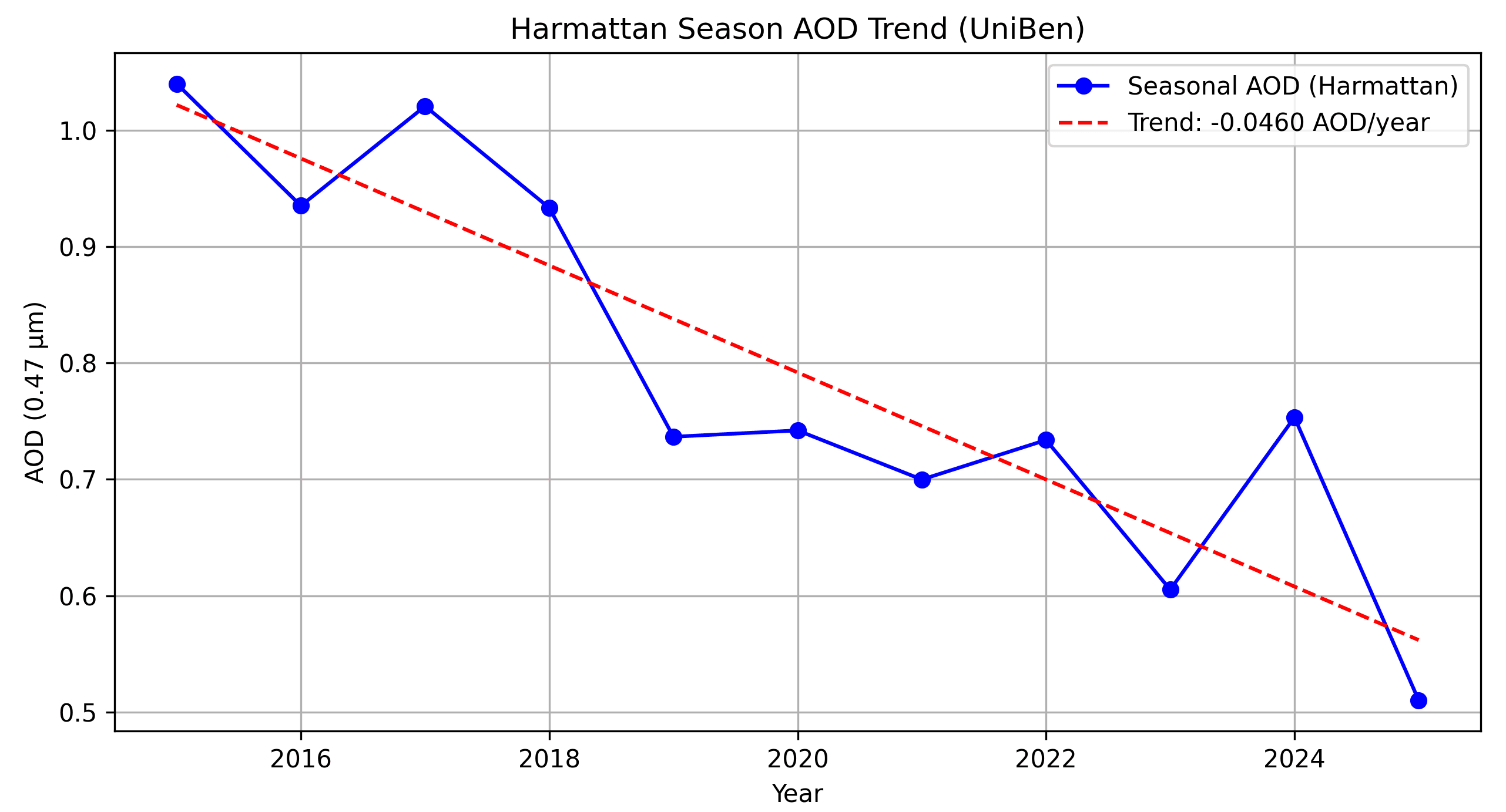
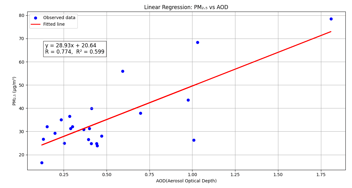
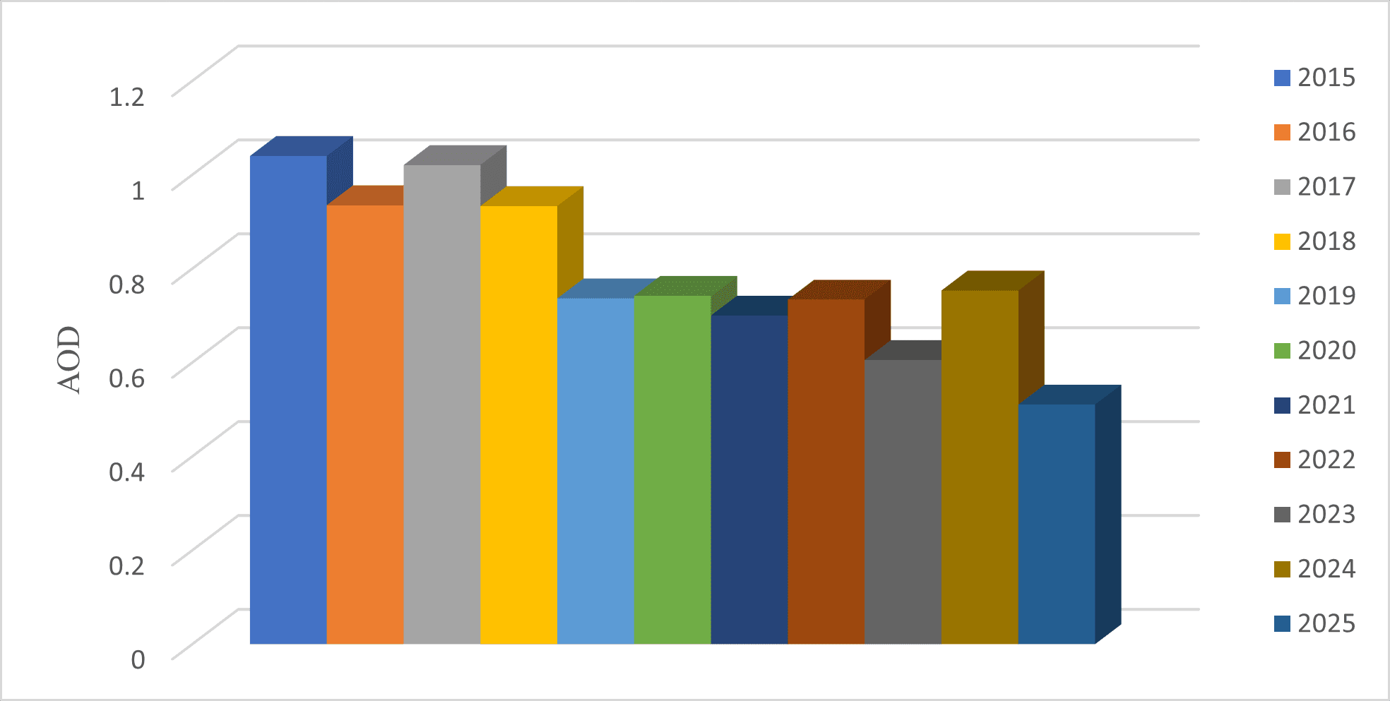
Processed and analyzed 10 years (2015–2024) of MODIS MAIAC aerosol data and ground-based PM₂.₅ observations using Google Earth Engine and Python to evaluate air-quality variability over the University of Benin. Developed and validated satellite-to-surface regression models linking aerosol optical depth (AOD) and PM₂.₅ concentrations.
Key Responsibilities
- Processed 10 years of MODIS MAIAC aerosol data using Google Earth Engine
- Analyzed ground-based PM₂.₅ observations
- Developed satellite-to-surface regression models linking AOD and PM₂.₅
- Validated models using observations from multiple monitoring locations in Benin City
Key Achievements
- ●Successfully developed validated regression models for air quality assessment
- ●Published findings in peer-reviewed journal
Research Assistant – TETFund Project
University of Benin – Department of Quantity Surveying
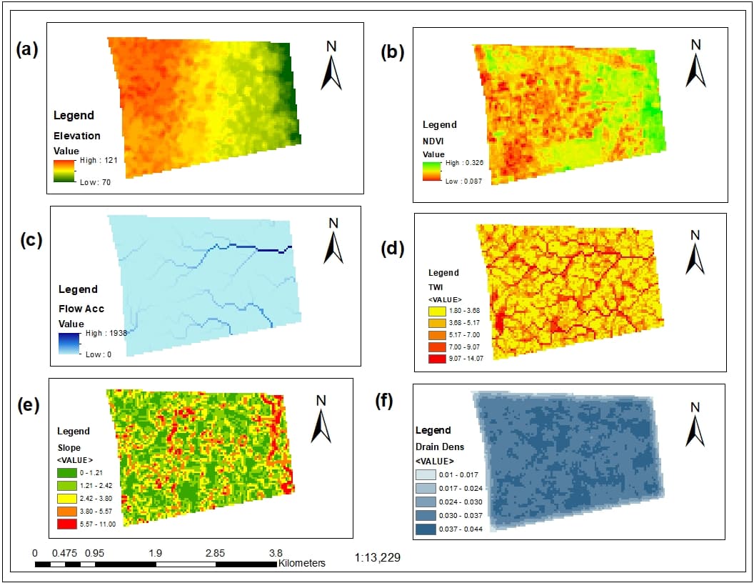
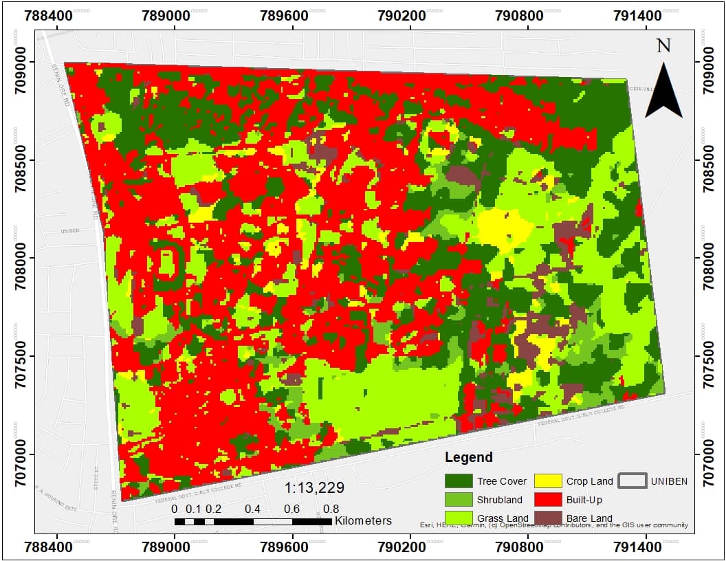
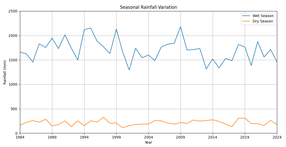
Analyzed 40‑year (1984–2024) rainfall variability using CHIRPS data, Mann–Kendall trend testing, Sen's slope estimation, and rainfall anomaly assessment. Developed a GIS‑based flood susceptibility model integrating DEM‑derived terrain factors, vegetation indices, land‑cover information, and multi‑criteria decision analysis (AHP) to identify flood‑prone zones within the University of Benin.
Key Responsibilities
- Analyzed 40‑year rainfall variability using CHIRPS datasets
- Performed Mann–Kendall trend testing and Sen's slope estimation
- Developed a GIS‑based flood susceptibility model using AHP
- Integrated DEM‑derived terrain factors, vegetation indices, and land‑cover data
Key Achievements
- ●Identified flood‑prone zones within the University of Benin
- ●Established reproducible GIS‑based flood modeling workflow
Research Collaborator – Niger River Morphodynamics
University of Benin – Department of Geomatics Engineering
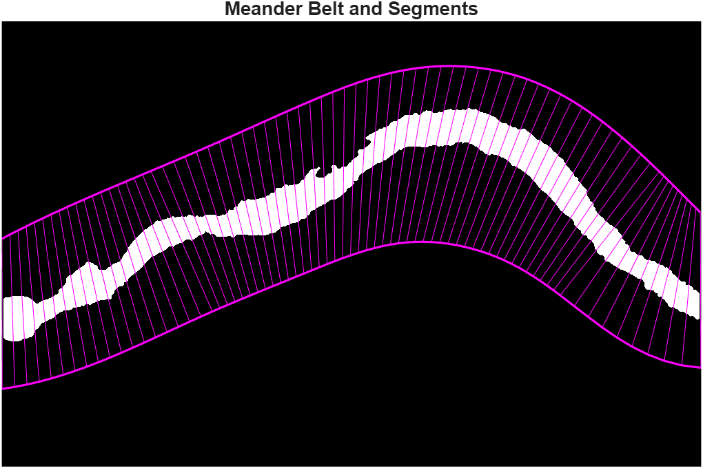
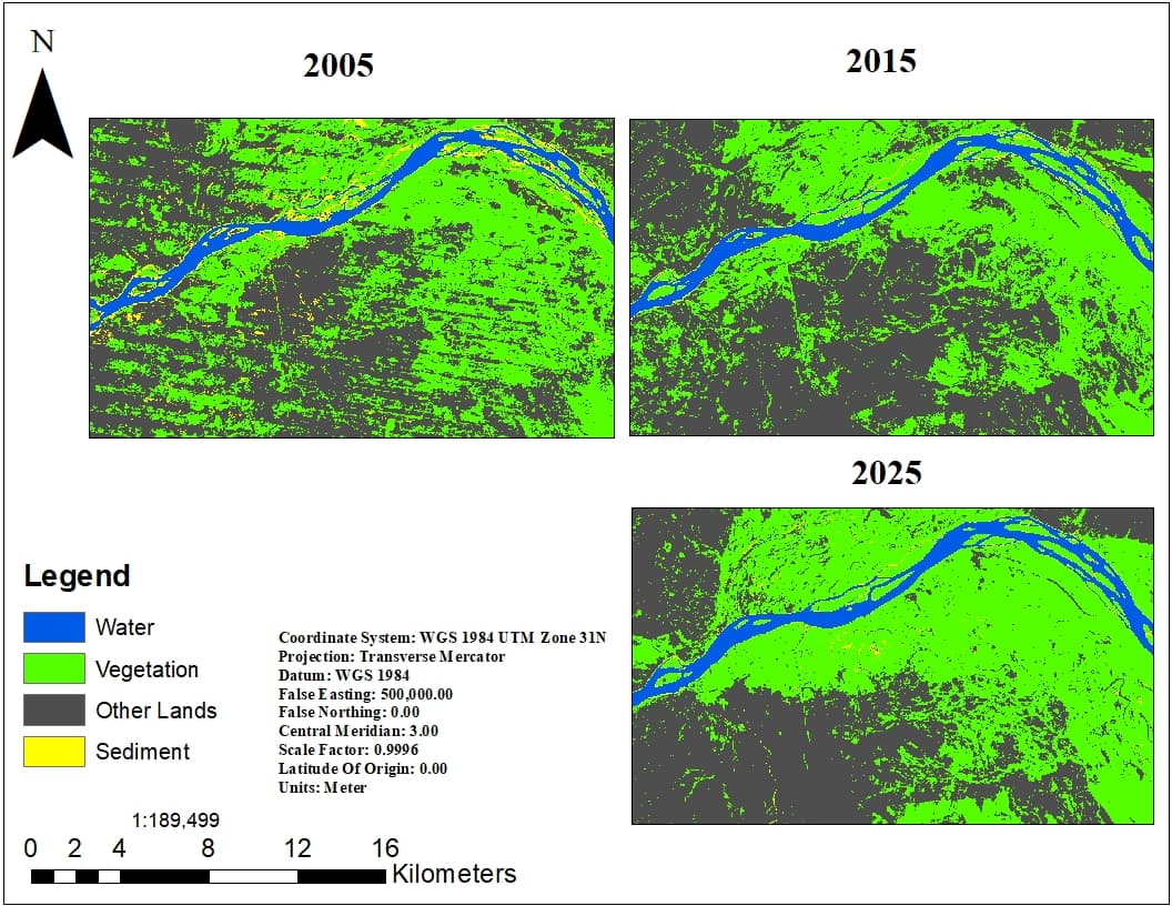
Developed an end-to-end workflow for analyzing 25 years (2001–2025) of Niger River morphodynamics downstream of the Kainji-Jebba dam cascade using Google Earth Engine, Landsat time-series, Random Forest classification, and RivMAP. Extracted centerlines, channel widths, sinuosity, migration rates, and erosion/accretion patterns to assess river stability and the impact of dam operations on channel morphology.

Key Responsibilities
- Developed and implemented GEE JavaScript code for extracting binary river masks from Landsat 4, 5, 7, and 8 imagery (1985–2025)
- Applied cloud masking, band harmonization, and spectral indices (NDWI, MNDWI, NDVI, BSI)
- Performed Random Forest classification for accurate water body extraction
- Used RivMAP toolbox in MATLAB to analyze centerlines, channel widths, sinuosity, and migration rates
- Created interactive web dashboard (Next.js, TypeScript, Leaflet) to visualize morphodynamic metrics
- Contributed to validation, visualization, and manuscript preparation
Key Achievements
- ●Built a reproducible end-to-end workflow from satellite imagery to morphodynamic metrics
- ●Published findings under review in peer-reviewed journal
- ●Created publicly accessible dashboard for river change visualization
Undergraduate Research
University of Benin – Department of Geomatics
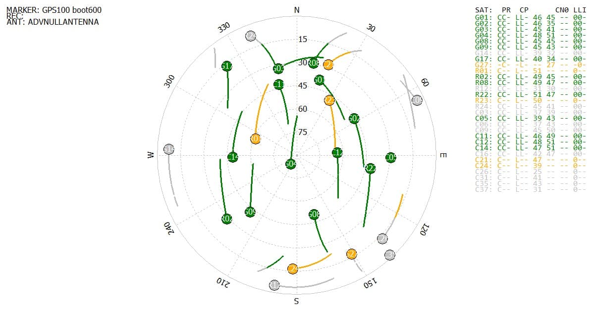
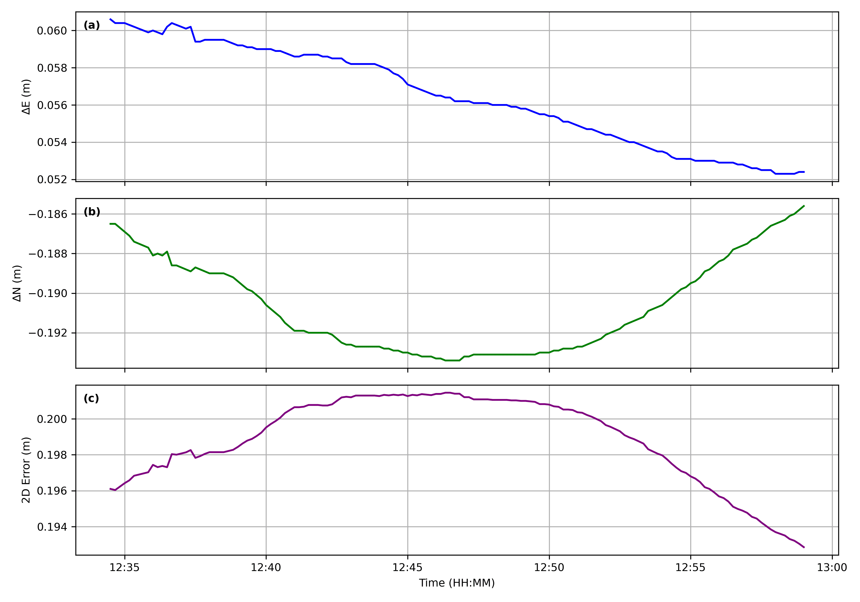
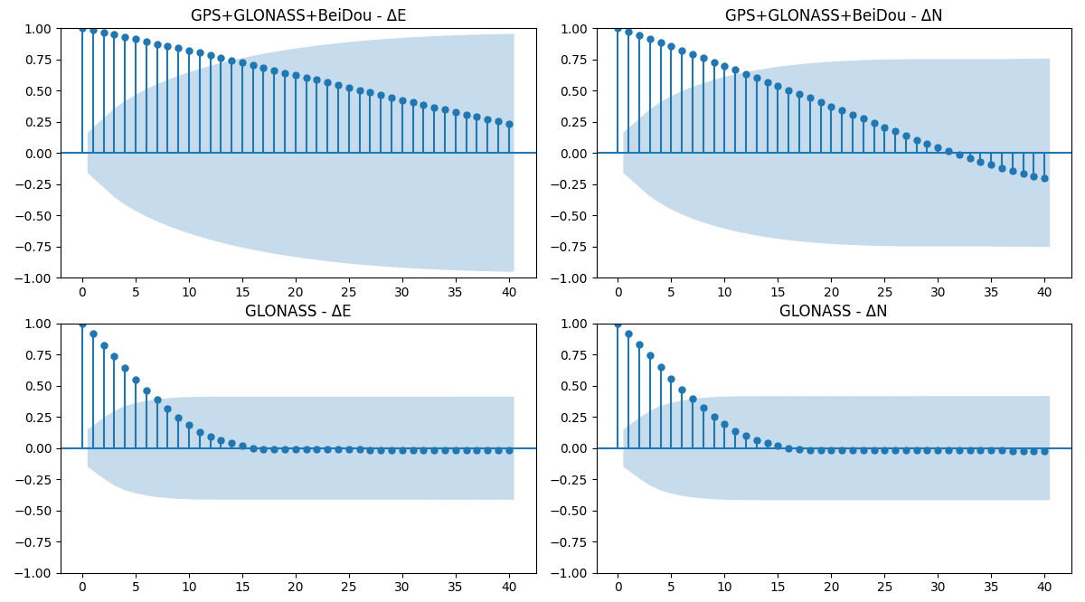
Evaluated multi-constellation GNSS positioning accuracy using static observations at five known control points, comparing ambiguity resolution performance and positioning errors across GPS, GLONASS, and BeiDou solutions. Processed using RTKLIB and Tersus Geomatics Office.
Key Responsibilities
- Conducted static GNSS observations at five known control points
- Compared ambiguity resolution performance across GPS, GLONASS, and BeiDou
- Processed data using RTKLIB and Tersus Geomatics Office
- Analyzed positioning errors for each constellation
Key Achievements
- ●Produced comprehensive accuracy assessment for multi-constellation GNSS
- ●Thesis currently under review for publication

Volunteering Experience
Building community through action. My volunteer work highlights my commitment to social impact and mentorship, applying my technical and interpersonal skills to support causes larger than myself.
Secretary General
Faculty of Environmental Student Association (FESSA)
Coordinated executive meetings, led tutorials, and advocated for the inclusion of Fine and Applied Arts students from the Ekehuan campus in faculty-wide activities. Worked to improve student engagement and representation across the faculty.
Peer Tutor – Undergraduate Tutor
University of Benin
Supported peers and junior students in Geomatics and Engineering courses. Organized study sessions and provided one-on-one guidance to simplify complex topics in courses like Engineering Mathematics, GNSS, Remote Sensing, and Geodesy. Also led introductory Geomatics tutorials for students in Architecture, Quantity Surveying, and Estate Management.

Volunteer Web Developer – Qiqi Farms (Agri-tech Platform)
QiqifarmsVolunteered to co-develop a website for Qiqi Farms, an agri-tech initiative focused on promoting agricultural products and improving access to farm-related services. Built a simple, responsive platform that presents the brand, its offerings, and makes it easier for users to connect with the business. Worked with a team to turn ideas into a live website.